- Irondequoit
-
Irondequoit Pueblo de los Estados Unidos Ubicación en el condado de Monroe y en el estado de Nueva York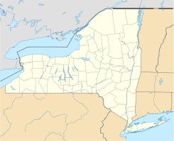
 Irondequoit
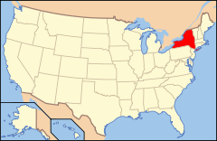
Ubicación de Nueva York en EE. UU.Coordenadas: Entidad Pueblo • País  Estados Unidos
• Estado  Nueva York
• Condado Monroe Supervisor municipal Mary Joyce D'Aurizio Superficie • Total 43 km² • Tierra 39 km² • Agua (9,69%) 4 km² Altitud • Media 112 msnm Población (2000) • Total 52.354 hab. • Densidad 1,329.7 hab/km² Huso horario Este: UTC-5 • en verano UTC-4 Código ZIP 14609, 14617, 14621, 14622 Código de área 585 Sitio web oficial Irondequoit es un pueblo y un lugar designado por el censo ubicado en el condado de Monroe en el estado estadounidense de Nueva York. En el año 2000 tenía una población de 52,354 habitantes y una densidad poblacional de 1,329.7 personas por km².
Contenido
Geografía
Irondequoit se encuentra ubicado en las coordenadas .[1]
Demografía
Según la Oficina del Censo en 2000 los ingresos medios por hogar en la localidad eran de $45,276, y los ingresos medios por familia eran $55,493. Los hombres tenían unos ingresos medios de $41,463 frente a los $30,937 para las mujeres. La renta per cápita para la localidad era de $23,638. Alrededor del 5.4% de la población estaban por debajo del umbral de pobreza.[2]
Referencias
- ↑ «U.S. Gazetteer: Censo de 2010» (en inglés). Oficina del Censo de los Estados Unidos (16 de febrero de 2011). Consultado el 11 de julio de 2011.
- ↑ «American FactFinder» (en inglés). Oficina del Censo de los Estados Unidos. Consultado el 11 de julio de 2011.
Enlaces externos
 Portal:Nueva York. Contenido relacionado con Nueva York.
 Wikimedia Commons alberga contenido multimedia sobre Irondequoit. Commons
Categorías:- Localidades del condado de Monroe
- Lugares designados por el censo en Nueva York
- Pueblos de Nueva York


Wikimedia foundation. 2010.