Koudekerke

Koudekerke
Koudekerke
Koudekerke, Michaëlskerk foto5 2010-09-18 11.12.JPG
Bandera  Koudekerke
Bandera

Escudo  Koudekerke
Escudo

Koudekerke
Koudekerke
Localización de Koudekerke en Países Bajos
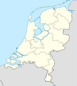
51°29′51″N 3°33′10″E / 51.4975, 3.55278Coordenadas: 51°29′51″N 3°33′10″E / 51.4975, 3.55278
Entidad Localidad
 • País Bandera de los Países Bajos Países Bajos
 • Provincia Zelanda
 • Municipio Veere
Población (2010)  
 • Total 3 495 hab.

Koudekerke es una localidad del municipio de Veere, en la provincia de Zelanda (Países Bajos). Está situada a unos 3 km de Flesinga.

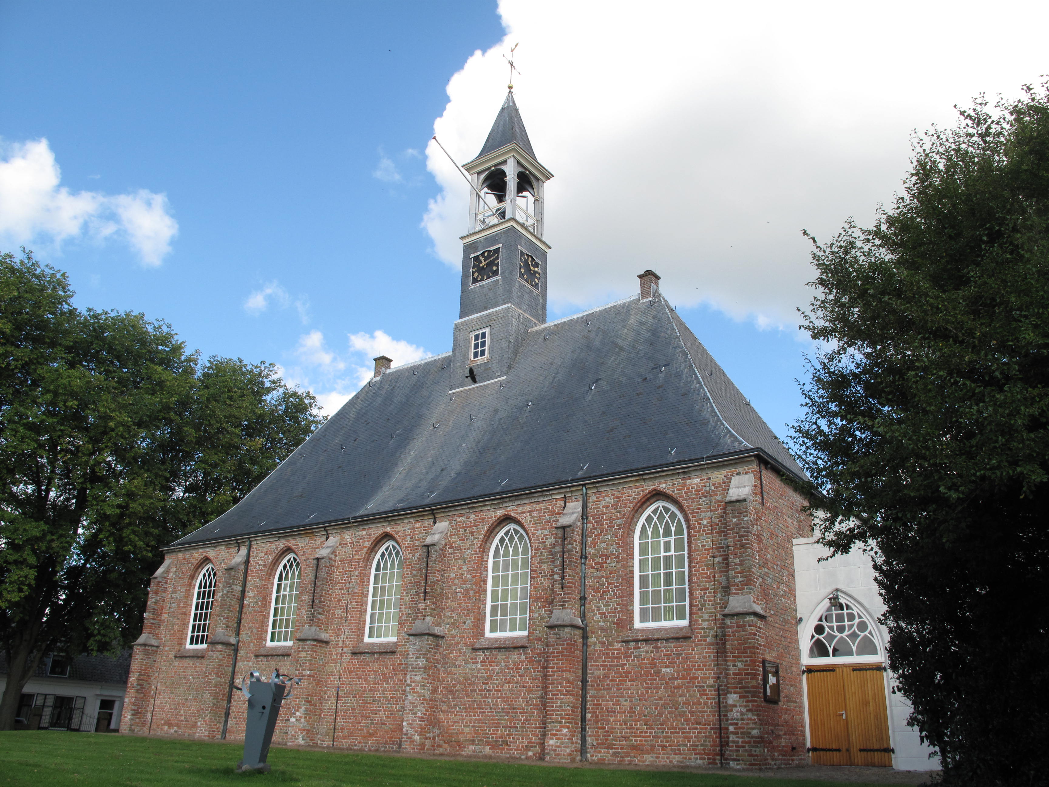
Históricamente, Koudekerke fue la unión entre dos líneas de ferrocarril de la provincia, Flesinga-Domburgo y el desvío a Middleburg. Aún quedan en pie como recuerdo de su construcción el depósito, la estación y las casas de los trabajadores.

Contó con municipio propio hasta el 1 de julio de 1966.[1]

Referencias

  1. Ad van der Meer and Onno Boonstra (2006); Repertorium van Nederlandse gemeenten. KNAW.

Wikimedia foundation. 2010.

Игры ⚽ Поможем написать курсовую

Mira otros diccionarios:

  • Koudekerke — Der Kreis Koudekerke (hellgrün) und der Dorfkern (dunkelgrün) in der Gemeinde Veere. Koudekerke ist ein Dorf in der niederländischen Provinz Zeeland. Es liegt etwa 2 km vom Strand und 3 km von Vlissingen entfernt auf der ehemaligen Insel… …   Deutsch Wikipedia

  • Koudekerke — Dutch town locator maps mun town caption = The town centre (dark green) and the statistical district (light green) of Koudekerke in the municipality of Veere.Koudekerke (coord|51|29|N|3|33|E|type:city(2687)) is a town in the Dutch province of… …   Wikipedia

  • Koudekerke — 51°28′51″N 3°33′10″E / 51.48083, 3.55278 …   Wikipédia en Français

  • Plompe Toren (Burgh-Haamstede) — Der Plompe Toren Der Plompe Toren auf einer …   Deutsch Wikipedia

  • Liste aller niederländischen Gemeinden M–Z — In diese Liste werden alle Gemeinden, die auf dem Gebiet der jetzigen Niederlande bestehen oder bestanden haben, aufgenommen. Die Liste beginnt im Jahr 1805/10. Vor 1830 können die Angaben unvollständig sein. Kleinere Grenzkorrekturen oder… …   Deutsch Wikipedia

  • Coudekerque-Village — Koudekerke Dorp Location of Coudekerque Village in the arrondissement of Dunkirk …   Wikipedia

  • Kinderdijk — Coordinates: 51°53′N 4°38′E / 51.883°N 4.633°E / 51.883; 4.633 …   Wikipedia

  • De Adriaan, Haarlem — Windmill De Adriaan De Adriaan is a windmill in the Netherlands that burnt down in 1932 and was rebuilt in 2002. The original windmill dates from 1779 and the mill has been a distinctive part of the skyline of Haarlem for centuries. Contents …   Wikipedia

  • List of Dutch exonyms for places in France — This is a list of Dutch exonyms for towns located in France.Département Nord * Armbouts Cappel Armboutskappel * Armentières Armentiers * Arnèke Arneke * Bac de Millam ? * Bailleul Belle * Bambecque Bambeke * Bavinchove Bavinkhove * Benkies Meulen …   Wikipedia

  • Liste der ehemaligen Gemeinden in Zeeland — Hierunter folgt eine Liste der ehemaligen seeländischen Gemeinden. Wenn das Gebiet einer aufgehobenen Gemeinde über mehrere Gemeinden verteilt worden ist, ist das Großteil der erstgenannten Gemeinde hinzugefügt. Grenzkorrekturen zwischen… …   Deutsch Wikipedia

Compartir el artículo y extractos

Link directo
Do a right-click on the link above
and select “Copy Link”