- Wardner (Idaho)
-
Wardner Ciudad de los Estados Unidos  Wardner en 1904Ubicación en el condado de Shoshone en Idaho
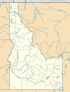
 Wardner
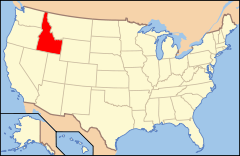
Ubicación de Idaho en EE. UU.Coordenadas: Entidad Ciudad • País  Estados Unidos
• Estado  Idaho
Idaho• Condado Shoshone Superficie • Total 2,22 km² • Tierra 2,22 km² • Agua (0%) 0 km² Altitud • Media 810 msnm Población (2010) • Total 188 hab. • Densidad 84,8 hab/km² Huso horario Pacífico: UTC-8 • en verano UTC-7 Código ZIP 83837 Código de área 208 Wardner es una ciudad ubicada en el condado de Shoshone en el estado estadounidense de Idaho. En el Censo de 2010 tenía una población de 188 habitantes y una densidad poblacional de 84,8 personas por km².[1]
Contenido
Geografía
Wardner se encuentra ubicada en las coordenadas . Según la Oficina del Censo de los Estados Unidos, Wardner tiene una superficie total de 2.22 km², de la cual 2.22 km² corresponden a tierra firme y (0%) 0 km² es agua.[2]
Demografía
Según el censo de 2010,[3] había 188 personas residiendo en Wardner. La densidad de población era de 84,8 hab./km². De los 188 habitantes, Wardner estaba compuesto por el 95.21% blancos, el 0% eran afroamericanos, el 1.06% eran amerindios, el 1.6% eran asiáticos, el 0% eran isleños del Pacífico, el 0.53% eran de otras razas y el 1.6% pertenecían a dos o más razas. Del total de la población el 2.66% eran hispanos o latinos de cualquier raza.[4]
Referencias
- ↑ «U.S. Gazetteer: Censo de 2010» (en inglés). Oficina del Censo de los Estados Unidos (16 de febrero de 2011). Consultado el 11 de julio de 2011.
- ↑ «Encuentra un condado» (en inglés). Asociación Nacional de Condados (11 de julio de 2011). Consultado el 11 de julio de 2011.
- ↑ «American FactFinder» (en inglés). Oficina del Censo de los Estados Unidos. Consultado el 11 de julio de 2011.
- ↑ «US Board on Geographic Names» (en inglés). Servicio Geológico de los Estados Unidos (25 de octubre de 2007). Consultado el 11 de julio de 2011.
Enlaces externos
 Portal:Idaho. Contenido relacionado con Idaho.
 Wikimedia Commons alberga contenido multimedia sobre Wardner (Idaho). Commons
Categorías:- Ciudades de Idaho
- Localidades del condado de Shoshone


Wikimedia foundation. 2010.