- West Kittanning
-
West Kittanning Borough de los Estados Unidos Ubicación en el condado de Armstrong en Pensilvania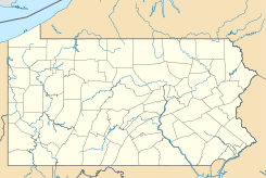
 West Kittanning
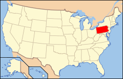
Ubicación de Pensilvania en EE. UU.Coordenadas: Entidad Borough • País  Estados Unidos
• Estado  Pensilvania
• Condado Armstrong Alcalde Bernie Bowser, Jr. Fundación 1900 Superficie • Total 1,0 km² • Tierra 1,0 km² • Agua (0%) 0 km² Población (2000) • Total 1.199 hab. • Densidad 1,157.3 hab/km² Huso horario Este: UTC-5 • en verano UTC-4 Código ZIP 16201 Código de área 724 Sitio web oficial West Kittanning es un borough ubicado en el condado de Armstrong en el estado estadounidense de Pensilvania. En el año 2000 tenía una población de 1.199 habitantes y una densidad poblacional de 1,157.3 personas por km².[1]
Contenido
Geografía
West Kittanning se encuentra ubicado en las coordenadas Coordenadas: [2] .
Demografía
Según la Oficina del Censo en 2000 los ingresos medios por hogar en la localidad eran de $32,850 y los ingresos medios por familia eran $41,458. Los hombres tenían unos ingresos medios de $31,587 frente a los $22,708 para las mujeres. La renta per cápita para la localidad era de $18,112. Alrededor del 7.5% de la población estaba por debajo del umbral de pobreza.[2]
Referencias
- ↑ «Encuentra un condado» (en inglés). Asociación Nacional de Condados (11 de julio de 2011). Consultado el 11 de julio de 2011.
- ↑ a b «U.S. Gazetteer: Censo de 2010» (en inglés). Oficina del Censo de los Estados Unidos (16 de febrero de 2011). Consultado el 11 de julio de 2011.
Enlaces externos
 Portal:Pensilvania. Contenido relacionado con Pensilvania.
 Wikimedia Commons alberga contenido multimedia sobre West Kittanning. Commons
Categorías:- Boroughs de Pensilvania
- Localidades del condado de Armstrong (Pensilvania)


Wikimedia foundation. 2010.