La Chapelle-Saint-Laurian

La Chapelle-Saint-Laurian
País Bandera de Francia Francia
• Región Centro
• Departamento Indre
• Distrito distrito de Issoudun
• Cantón cantón de Vatan
• Mancomunidad Communauté de communes du canton de Vatan
Ubicación 47°3′47″N 1°47′2″E / 47.0630555556, 1.78388888889Coordenadas: 47°3′47″N 1°47′2″E / 47.0630555556, 1.78388888889
• Altitud 200 msnm
(mín.: 125, máx.: 174)
Superficie 9,82 km²
Población 141 hab. (1999)
• Densidad 14,36 hab./km²
Código postal 36150
Alcalde
2008-2014
Código INSEE 36041
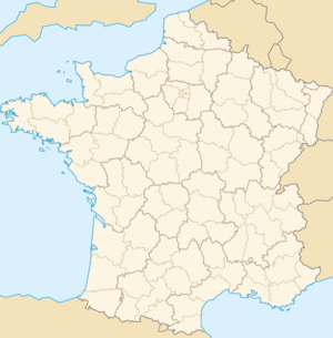
Ubicación de La Chapelle-Saint-Laurian en Francia

La Chapelle-Saint-Laurian es una población y comuna francesa, en la región de Centro, departamento de Indre, en el distrito de Issoudun y cantón de Vatan.

Demografía

Datos de población
1962 1968 1975 1982 1990 1999
187 162 140 162 135 141
Para los censos de 1962 a 1999 la población legal corresponde a la población sin duplicidades, según define el INSEE.

Enlaces externos


Wikimedia foundation. 2010.

Игры ⚽ Поможем решить контрольную работу

Mira otros diccionarios:

  • La Chapelle-Saint-Laurian — Pour les articles homonymes, voir La Chapelle.  Ne doit pas être confondu avec La Chapelle Saint Laurent …   Wikipédia en Français

  • La chapelle-saint-laurian — Pour les articles homonymes, voir La Chapelle.  Ne doit pas être confondu avec La Chapelle Saint Laurent. La Chapelle Saint Laurian …   Wikipédia en Français

  • La Chapelle-Saint-Laurian — Infobox Commune de France nomcommune=La Chapelle Saint Laurian région=Centre département=Indre arrondissement=Issoudun canton=Vatan insee=36041 cp=36150 maire=René Gauthier mandat=2001 2014 intercomm=Vatan longitude=1.78388888889… …   Wikipedia

  • La chapelle-saint-laurent — Pour les articles homonymes, voir La Chapelle.  Ne doit pas être confondu avec La Chapelle Saint Laurian. La Chapelle Saint Laurent …   Wikipédia en Français

  • La Chapelle-Saint-Laurent — Pour les articles homonymes, voir La Chapelle.  Ne doit pas être confondu avec La Chapelle Saint Laurian …   Wikipédia en Français

  • Saint-florentin (indre) — Pour les articles homonymes, voir Saint Florentin. Saint Florentin Administration Pays France Région Centre …   Wikipédia en Français

  • Saint-pierre-de-jards — Administration Pays France Région Centre Département Indre Arrondissement Issoudun Canton …   Wikipédia en Français

  • Saint-Florentin (Indre) — Pour les articles homonymes, voir Saint Florentin. 47° 04′ 36″ N 1° 48′ 19″ E …   Wikipédia en Français

  • Chapelle — Contents 1 People 2 Communes in France 3 Other places 4 …   Wikipedia

  • Saint-Pierre-de-Jards — 47° 05′ 54″ N 1° 58′ 03″ E / 47.0983, 1.96750 …   Wikipédia en Français

Compartir el artículo y extractos

Link directo
Do a right-click on the link above
and select “Copy Link”