Tap O' Noth

Tap O' Noth
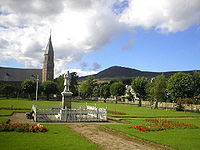
La ciudad de Rhynie y al fondo la colina de Tap O' Noth.

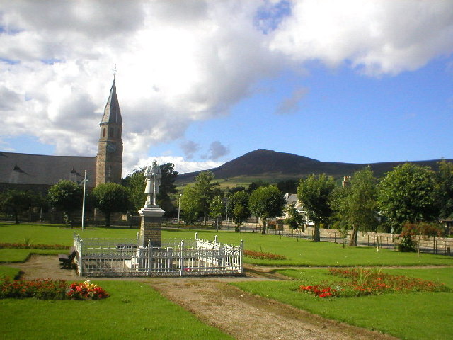
Tap O' Noth es un castro situado en la localidad escocesa de Rhynie en el condado de Aberdeenshire a unos 22 kilómetros al noroeste de Alford. Es el segundo castro situado a mayor altitud de Escocia (563 m.), comprende un área aproximada de 21 hectáreas rodeadas de un muro perimetral de piedra.[1] En el yacimiento se han localizado varios restos de casas de planta circular aunque las estructuras más sobresalientes son los muros que delimitan el espacio interior. Estos muros se encuentran en varias zonas vitrificados, esto es sus rocas han sido fusionadas por la acción de altas temperaturas en una técnica constructiva parcialmente desconocida que buscaba aumentar la solidez de la construcción.[2] Las excavaciones realizadas en el interior del castro han deparado varios utensilios de notable interés, uno de ellos, un hacha de piedra datada entre el 2.000 y el 800 a. C. y otra un anillo de bronce con decoración datado entre los siglos III a I a.C. perteneciente probablemente a un carro de combate.[3]

Referencias

Coordenadas: 57°21′6″N 2°51′27″O / 57.35167, -2.8575


Wikimedia foundation. 2010.

Игры ⚽ Поможем сделать НИР

Mira otros diccionarios:

  • Tap o’ Noth — Tap o’ Noth …   Deutsch Wikipedia

  • Tap o' Noth — The Tap o Noth is a hill fort on top of the Hill of Noth, 20 miles west of Inverurie in Aberdeenshire, Scotland at grid reference NJ485293. It is the second highest fort in Scotland and its main feature is its well preserved vitrified wall which… …   Wikipedia

  • Aberdeenshire (historic) — County of Aberdeen Aberdeenshire within Scotland in 1890 Geography Status County (until 1975) …   Wikipedia

  • Aberdeenshire — Siorrachd Obar Dheathain Verwaltungssitz Aberdeen Fläche 6.313 km² …   Deutsch Wikipedia

  • GB-ABD — Aberdeenshire Siorrachd Obar Dheathain Verwaltungssitz Aberdeen Fläche 6.313 km² (4.) …   Deutsch Wikipedia

  • Rhynie — Saltar a navegación, búsqueda Iglesia de Rhynie, al fondo el castro de Tap O Noth. Rhynie es una localidad escocesa perteneciente al condado de Aberdeenshire a unos 22 kilómetros al noroeste de Alford. Esta antigua ciudad, conocida durante la… …   Wikipedia Español

  • Vitrified fort — is the name given to certain crude stone enclosures whose walls have been subjected in a greater or less degree to the action of fire [cite web |url=http://www.brigantesnation.com/VitrifiedForts/VitrifieedForts.htm |title=Vitrification of Hill… …   Wikipedia

  • List of community council areas in Scotland — This is a list of community council areas established in each of the council areas of Scotland.Aberdeen CityThere are 31 community council areas in the council area. Those marked with an asterisk have a community council. [… …   Wikipedia

  • List of hill forts in Scotland — This List of hill forts in Scotland is a page for any hill fort in Scotland, UK.Aberdeenshire* Bennachie * Tap o NothArgyll Bute* DunaddBorders* Edin s Hall Broch * Eildon hill fort (redirected to:) Trimontium (Newstead)East Lothian* Black Castle …   Wikipedia

  • Dunnideer — (ursprünglich Dun Nideer) ist ein so genanntes Hillfort auf einem 268 m hohen kegelförmigen Hügel westlich von Insch, in der schottischen Grafschaft Aberdeenshire. Die in zwei Phasen errichtete Anlage wird von fünf einigermaßen… …   Deutsch Wikipedia

Compartir el artículo y extractos

Link directo
Do a right-click on the link above
and select “Copy Link”