- Hei Ling Chau
-
Isla Hei Ling Chau
喜 灵 洲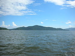
Vista de la islaLocalización País  China
ChinaRegión administrativa especial  Hong Kong
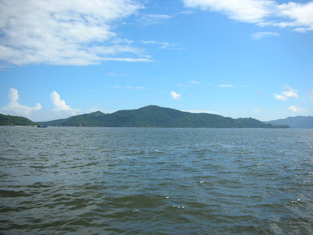
Coordenadas Coordenadas: Geografía Superficie 1,93 km² Punto más alto 187 m Hei Ling Chau (chino tradicional: 喜 灵 洲, literalmente "Isla de la Sanación feliz" / "Alma alegre"),[1] antes Hayling Chau, es una isla de la región administrativa especial de Hong Kong, en China situada al este de la Bahía Silver Mine y de las islas de Chi Ma Wan y Lantau. Es administrativamente parte del Distrito de las Islas.
Contenido
Historia
La isla fue originalmente llamada Isla Nai Gu (尼姑 洲). Se poblara al final del siglo 19, y en 1951, había 10 familias que representaban cerca de 100 personas en la isla. Fue designado como una colonia de leprosos en 1950 y los isleños fueron trasladados a Tai Pak, Shap Long y Cheung Chau. La isla pasó a llamarse luego Hei Ling Chau. En una época en la década de 1960, el hospital de leprosos llegó a un máximo de 540 pacientes. La colonia fue cerrada en 1974, y los pacientes restantes fueron trasladados al nuevo hospital de Lai Chi Kok. La isla fue posteriormente administrada por el Departamento de Servicios Correccionales.[1]
Geografía
Hei Ling Chau se encuentra al sur de Peng Chau y el norte de Cheung Chau. Su compañera, la Isla del Sol, se encuentra en su noreste. Tiene una superficie de 1,93 km²,[2] y la montaña más alta alcanza los 187 metros de altura. La isla tiene forma de L con un ángulo apuntando hacia el noreste.
Véase también
Referencias
Enlaces externos
 Wikimedia Commons alberga contenido multimedia sobre Hei Ling Chau. Commons
Categoría:- Archipiélagos e islas de Hong Kong
Wikimedia foundation. 2010.