The Wolds

The Wolds
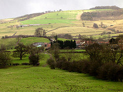
Wolds en Yorkshire, Inglaterra.

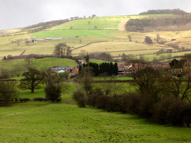
The Wolds es un término utilizado en Inglaterra para describir una serie de colinas de baja elevación y abruptos valles que consisten de terreno abierto que se extiende sobre una base de caliza o tiza que se depositaron durante el período Cretácico. La configuración de valles amplios de los Wolds se conformó durante la última era glaciar mediante el desgaste producido por los glaciares y el agua de deshielo.

Existen dos zonas con estas características, ambas remanentes de un sistema de tiza mucho más extenso. Desde un punto de vista geológico ambas forman parte de una misma formación pero se encuentran separadas fisicamente por el estuario del Humber.

Adicionalmente se encuentran los Cotswolds, que son un conjunto de colinas de caliza en el Sudoeste de Inglaterra.

Véase también


Coordenadas: 53°45′N 0°30′W / 53.75, -0.50


Wikimedia foundation. 2010.

Игры ⚽ Нужно сделать НИР?

Mira otros diccionarios:

  • (the) Wolds — the Wolds [the Wolds] noun [pl] two ranges of hills in north east England. The range to the north of the River ↑Humber used to be called the Yorkshire Wolds, and is now simply called the Wolds. The range to the south of the Humber is known as the …   Useful english dictionary

  • The Wolds —   [ȓə wɔʊldz] Plural, Kreidekalkschichtstufen in Ostengland. Nördlich des Humber liegen die York Wolds (Yorkshire Wolds), bis 246 m über M., südlich des Humber die Lincoln Wolds, bis 167 m über M. In den durch zahlreiche Trockentäler gegliederten …   Universal-Lexikon

  • The Wolds — is a term used in England to describe a range of hills which consists of open country overlying a base of limestone or chalk. There are at least two such areas, both remnants of a much larger chalk system. They are geologically a single range but …   Wikipedia

  • Normanton-on-the-Wolds — Coordinates: 52°53′N 1°06′W / 52.88°N 1.1°W / 52.88; 1.1 …   Wikipedia

  • Middleton on the Wolds — Coordinates: 53°56′01″N 0°33′44″W / 53.933730°N 0.562340°W / 53.933730; 0.562340 …   Wikipedia

  • Garton on the Wolds — infobox UK place country = England latitude = 54.021328 longitude = 0.500170 official name = Garton on the Wolds population = 299 (2001 census) civil parish = Garton on the Wolds unitary england = East Riding of Yorkshire region = Yorkshire and… …   Wikipedia

  • Willoughby on the Wolds — infobox UK place country = England static static image caption= latitude= 52.82 longitude= 1.06 official name =Willoughby On The Wolds population =484 shire district=Rushcliffe shire county= Nottinghamshire region= East Midlands constituency… …   Wikipedia

  • Burton on the Wolds — is a village situated on the B676 3 miles west of the A46 in Leicestershire and has a population of around 800. The Parish Council of Burton on the Wolds, Cotes and Prestwold serves the village and its two neighbouring hamlets. The local borough… …   Wikipedia

  • Foston on the Wolds — infobox UK place country = England latitude= 53.987217 longitude= 0.322090 official name= Foston on the Wolds population= 253 (2001 census) civil parish= Foston on the Wolds unitary england = East Riding of Yorkshire region= Yorkshire and the… …   Wikipedia

  • Church of St Mary and All Saints, Willoughby-on-the-Wolds — Coordinates: 52°49′22″N 01°03′39″W / 52.82278°N 1.06083°W / 52.82278; 1.06083 …   Wikipedia

Compartir el artículo y extractos

Link directo
Do a right-click on the link above
and select “Copy Link”