Mafeteng

Mafeteng
Mafeteng
Mafeteng
Mafeteng
Localización de Mafeteng en Lesoto
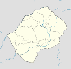
País Flag of Lesotho.svg Lesoto
• Distrito Butha-Buthe
Ubicación 29°49′20″S 27°14′19″E / -29.82222, 27.23861
• Altitud 1674 msnm
Población 40887[1] hab. (est 2010)
Huso horario UTC+2

Mafeteng es una localidad de Lesoto, cabecera del distrito homónimo.

Demografía

Según censo 1986 contaba con 12.667 habitantes. La estimación 2010 refiere a 40.887 habitantes.[1]

Referencias


Wikimedia foundation. 2010.

Игры ⚽ Нужно решить контрольную?

Mira otros diccionarios:

  • Mafeteng — A view of Likhoele, Mafeteng s second highest mountain, from the reservoir by Kingsgate Primary School …   Wikipedia

  • Mafeteng — Administration Pays  Lesotho …   Wikipédia en Français

  • Mafeteng — 29.82277777777827.245 Koordinaten: 29° 49′ S, 27° 15′ O …   Deutsch Wikipedia

  • Mafeteng — Original name in latin Mafeteng Name in other language MFC, Mafeteng State code LS Continent/City Africa/Maseru longitude 29.823 latitude 27.23744 altitude 1669 Population 57059 Date 2012 01 18 …   Cities with a population over 1000 database

  • Mafeteng — Admin ASC 1 Code Orig. name Mafeteng Country and Admin Code LS.13 LS …   World countries Adminstrative division ASC I-II

  • Mafeteng District — Mafeteng   District   Map of Lesotho with the district highlighted Country …   Wikipedia

  • Mafeteng (Distrikt) — Karte Lage des Mafeteng Distrikts in Lesotho Basisdaten Verwaltungsstadt Mafeteng Fläche 2.119 km² …   Deutsch Wikipedia

  • Mafeteng — …   Useful english dictionary

  • District De Mafeteng — Mafeteng Administration Pays Lesotho Type District Capitale Mafeteng …   Wikipédia en Français

  • District de mafeteng — Mafeteng Administration Pays Lesotho Type District Capitale Mafeteng …   Wikipédia en Français

Compartir el artículo y extractos

Link directo
Do a right-click on the link above
and select “Copy Link”