- Manamoc
-
Isla de Manamoc 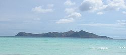
Vista de la IslaLocalización País  Filipinas
Provincia Provincia de Palawan Océano Océano Pacífico Coordenadas Coordenadas: Geografía Geología Isla marítima Superficie 5,16 km² Largo máximo 3,2 km Ancho máximo 2,7 km Punto más alto 219 m Demografía Población 2.001 (2007) Otros datos Municipio Cuyo
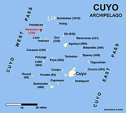
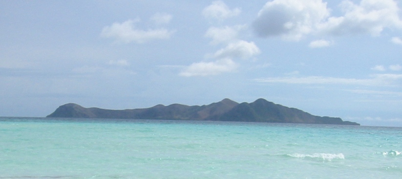
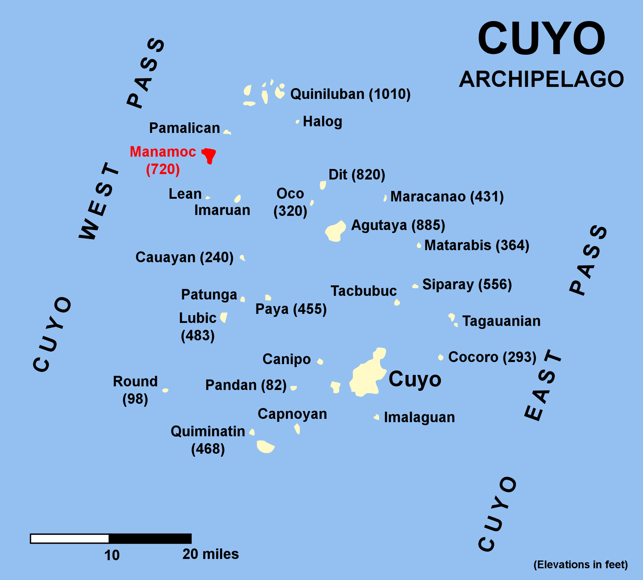
Mapa de localizaciónManamoc[1] es una isla-barangay en el Mar de Sulu, en la parte noreste de la provincia de Palawan,[2] en Filipinas. Se trata de una parte del grupo Quiniluban de las islas del archipiélago de Cuyo entre las islas de Palawan y la de Panay.
Manamoc, como la mayoría de las islas de Cuyo, es de origen volcánico. La isla casi circular tiene un diámetro de alrededor de 3,8 Km y tiene una superficie total de 1.275 acres (516 hectáreas). Está rodeada por arrecifes de coral y abundante vida marina. Una ruptura en el arrecife permite a los botes entrar en la laguna en la parte suroeste de la isla. Esta laguna tiene unos 3 metros de profundidad en marea baja
Véase también
- Geografía de Filipinas
- Geografía de Asia
Referencias
Enlaces externos
Categoría:- Archipiélagos e islas de Filipinas
Wikimedia foundation. 2010.