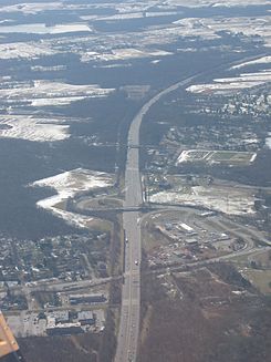
- New Jersey Turnpike
-
New Jersey Turnpike


 Nueva Jersey,
  Estados Unidos
Inauguración 1951 Longitud 122.40 mi (196.98 km)[1] [2]
11,03 mi (17,75 km) Ramal Occidental[3]
6,55 mi (10,54 km) Extension a Pensilvania[2]
8,17 mi (13,1 km) Extensión a la Bahía de Newark[4]Orientación Sur a Norte • Sur 
 I-295/US 40 en Pennsville
• Norte 

 I-95/US 1/9/46 en Fort Lee
Cruces 

 I-95/I-276/PA Tpk en Municipio de Mansfield
 I-195 en el Municipio de Robbinsville
 NJ 18 en el Municipio de East Brunswick

 I-287/NJ 440 en Municipio de Edison

 GSP/US 9 en el Municipio de Woodbridge
 I-278 en Linden/Elizabeth
 I-78 en Newark
 I-280 en Kearny
 NJ 495 en Secaucus
 I-80 en Teaneck Township
Concesionaria la Autoridad del New Jersey Turnpike New Jersey Turnpike es un peaje en Nueva Jersey y es una de las carreteras más transitadas en los Estados Unidos (según el IBTTA, el turnpike es el peaje más transitado de los Estados Unidos[5] ). Gran parte de la carretera, al igual que sus principales ramales, forman parte del Sistema Interestatal de Autopistas. La construcción del Turnpike tomó 23 meses, desde 1950 a 1952. El Turnpike tiene una anchura en cada carril de 12 pie (3,7 m), y de anchura total 10 pie (3 m), 13 áreas de descanso fueron nombradas de residentes famosos de Nueva Jersey. El Sistema Interestatal de Autopistas tomó la guía de diseño de esta carretera para aplicarlo en las guías de diseño de las "turnpikes".
Contenido
Véase también
Citas
- Gillespie, Angus Kress; Rockland, Michael Aaron (1989), Looking for America on the New Jersey Turnpike, Rutgers University Press, ISBN 0-8135-1466-5
- Shadely, John (1973), Acoustical analysis of the New Jersey Turnpike widening project between Raritan and East Brunswick, Bolt, Beranek and Newman
Referencias
- ↑ «Route 700 Straight Line Diagram» (PDF). NJDOT. Consultado el 26-04-2007.
- ↑ a b «Route 95 Straight Line Diagram» (PDF). NJDOT. Consultado el 26-04-2007.
- ↑ «Route 95W Straight Line Diagram» (PDF). NJDOT. Consultado el 26-04-2007.
- ↑ «Route 78 Straight Line Diagram» (PDF). NJDOT. Consultado el 26-04-2007.
- ↑ «International Bridge, Tunnel and Turnpike Association». IBTTA (03-10-2007). Consultado el 02-06-2009.
Enlaces externos
 Wikimedia Commons alberga contenido multimedia sobre New Jersey Turnpike. Commons
- New Jersey Turnpike Authority (& Garden State Parkway) Sitio oficial
- NJTP official website for Interchange 6 to 9 Widening Program
- nycroads.com; New Jersey Turnpike Historic Overview
- An expanded view of road jurisdiction near the confluence of US 46, I-95 / NJTurnpike, I 280, NJ 7 and CR 508 in Kearny
Categorías:- Carreteras estatales de Nueva Jersey
- Carreteras de peaje de Estados Unidos
- Arquitectura de 1951
- Condado de Middlesex (Nueva Jersey)
Wikimedia foundation. 2010.

