Sadarak

Sadarak

Sadarak

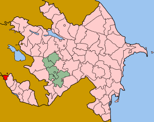
Localización de Sadarak resaltada con rojo en el mapa azerí.

Sadarak (Azerí: Sədərək) es uno de los cincuenta y nueve rayones de Azerbaiyán, se encuentra localizado en la República Autónoma de Najicheván. Tiene un enclave en Armenia, Karki que ha estado bajo control armenio desde mayo de 1992, cuando fue capturado durante la guerra de Nagorno-Karabaj. Su ciudad capital es la ciudad de Heydarabad.

Territorio y Población

Posee una superficie de 151,4 kilómetros cuadrados, los cuales son el hogar de una población compuesta por unas 12.613 personas. Por ende, la densidad poblacional se eleva a la cifra de los 83,5 habitantes por cada kilómetro cuadrado de este rayón.

Obtenido de "Sadarak"

Wikimedia foundation. 2010.

Игры ⚽ Нужен реферат?

Mira otros diccionarios:

  • Sadarak — may refer to: * Sadarak Rayon, Azerbaijan * Sədərək, Azerbaijan, capital of the above …   Wikipedia

  • Sadarak Rayon — Sadarak (Sədərək) is a rayon of Azerbaijan in the Nakhchivan Autonomous Republic. It was split from the Ilyich rayon (present day Sharur) in 1990. It has an exclave in Armenia, Karki which has been under Armenian control since May 1992 when it… …   Wikipedia

  • Sadarak (Rayon) — Lage des Rayons Sədərək in Aserbaidschan Sədərək ist ein Rayon in Aserbaidschan in der Autonomen Republik Nachitschewan. Die Hauptstadt des Bezirks ist die Stadt Heydərabad. Zum Bezirk gehört die Exklave Karki, die in Armenien liegt und seit dem… …   Deutsch Wikipedia

  • Sadarak Rayon — Admin ASC 2 Code Orig. name Sadarak Rayon Country and Admin Code AZ.35.409387 AZ …   World countries Adminstrative division ASC I-II

  • Route européenne 002 — Caractéristiques Itinéraire D Alyat  …   Wikipédia en Français

  • Nakhchivan — This article is about the autonomous region. For its capital city, see Nakhchivan City. For the Armenian settlement of Nor Nakchivan, see New Nakhichevan. Nakhchivan Autonomous Republic Naxçıvan Muxtar Respublikası …   Wikipedia

  • Sədərək — For the administrative district, see Sadarak Rayon. Infobox Settlement name =Sədərək settlement type=Municipality native name = pushpin pushpin mapsize =300 subdivision type = Country subdivision name = flag|Azerbaijan subdivision type1 =… …   Wikipedia

  • Karki, Azerbaijan — Karki Tigranashen Տիգրանաշէն View of Tigranashen from the main north south highway of Armenia …   Wikipedia

  • Administrative divisions of Azerbaijan — Map of the administrative divisions of Azerbaijan. Note that the divisions of the Nakhchivan exclave are listed in the next section. 1. Absheron Rayon 2. Aghjabadi Rayon 3. Agdam Rayon 4. Agdash Rayon 5. Agstafa Rayon 6 …   Wikipedia

  • Erivan khanate — The Erivan (Yerevan) khanate ( fa. ایروان) was a Muslim controlled principality under the dominion of the Persian Empire between 1747 and 1828. Its territory roughly corresponded to most of present day central Armenia, most of the Iğdır Province… …   Wikipedia

Compartir el artículo y extractos

Link directo
Do a right-click on the link above
and select “Copy Link”