Tamanredjo

Tamanredjo
Tamanredjo
Commewijne resorts.png
Distrito de Coronie, Tamanredjo en verde claro
País Surinam Bandera de Surinam
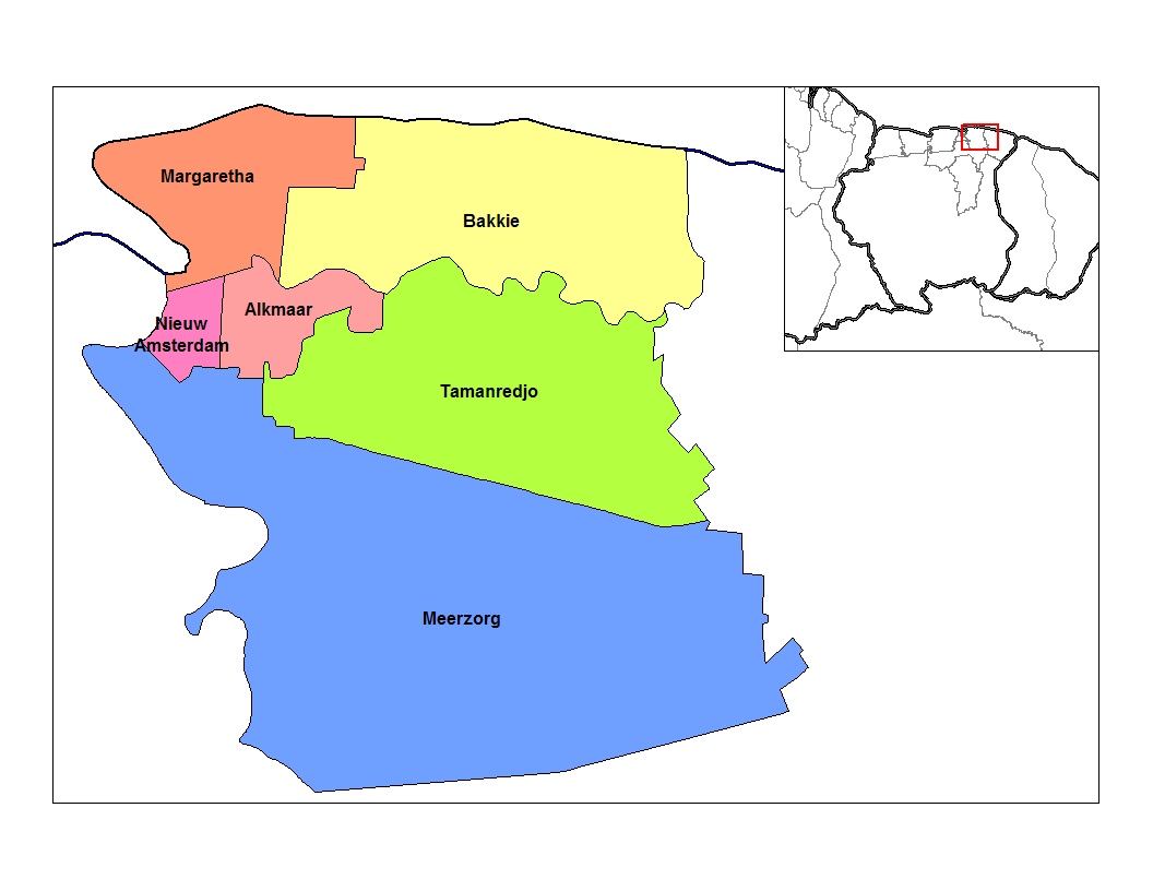
• Distrito Commewijne
• Suburbio Tamanredjo
Ubicación 5°46′N 55°0′O / 5.767, -55
Población 1200[1] hab.
Huso horario UTC-3

Tamanredjo es uno de los suburbios, en holandés ressort, en los que está subdividido el Distrito de Commewijne en Surinam. Se encuentra al sur de Alkmaar, sobre la carretera que atraviesa la nación desde Albina hasta Nieuw-Nickerie, y es un lugar de abastecimiento de gasolina en la región; el suburbio tiene alrededor de 5.500 habitantes. Fue construido 1937 como una aldea para los inmigrantes de Java, en la actualidad es uno de los mayores asentamientos de la población del distrito.,[2] se asienta en las coordenadas: 5°46′N 55°0′O / 5.767, -55

Referencias

  1. Thomas Brinkhoff (2007). «Datos de Población de Surinam» (en holandés). Consultado el 7 de diciembre de 2009.
  2. «Distrikt Commewijne info».

Wikimedia foundation. 2010.

Игры ⚽ Нужно сделать НИР?

Mira otros diccionarios:

  • Commewijne District — Map of Suriname showing Commewijne district Commewijne is a district of Suriname, located on the right bank of the Suriname River. Commewijne s capital city is Nieuw Amsterdam. Alliance is another major town. The district has a population of… …   Wikipedia

  • Commewijne — Distrito de Surinam Capital Nieuw Amsterdam …   Wikipedia Español

  • Districts of Suriname — Suriname This article is part of the series: Politics and government of Suriname Constitution President …   Wikipedia

  • Coronie District — Map of Suriname showing Coronie district Coronie is a district of Suriname, situated on the coast. Coronie s capital city is Totness, with other towns including Corneliskondre, Friendship, Jenny. The district border the Atlantic Ocean to the… …   Wikipedia

  • Marowijne District — Map of Suriname showing Marowijne district Marowijne is a district of Suriname, located on the north east coast. Marowijne s capital city is Albina, with other towns including Moengo and Wanhatti. The district borders the Atlantic Ocean to the… …   Wikipedia

  • Nickerie District — Map of Suriname showing Nickerie district Nickerie is a district of Suriname, on the north west coast. Nickerie s capital city is Nieuw Nickerie, the second largest city in the country. Other towns include Washoda and Wageningen. The district… …   Wikipedia

  • Saramacca District — Coordinates: 5°46′57″N 55°37′29″W / 5.7825°N 55.62472°W / 5.7825; 55.62472 …   Wikipedia

  • Moengo —   Resort   Map showing the resorts of Marowijne District …   Wikipedia

  • Nieuw Amsterdam, Suriname — Nieuw Amsterdam   Resort and town   …   Wikipedia

  • Resorts of Suriname — The districts of Suriname are divided into 62 resorts ( ressorten ). The resorts are listed below, by district:Brokopondo District*Brownsweg *Centrum *Klaaskreek *Kwakoegron *Marshallkreek *SarakreekCommewijne District*Alkmaar *Bakkie *Margaretha …   Wikipedia

Compartir el artículo y extractos

Link directo
Do a right-click on the link above
and select “Copy Link”