Teyateyaneng

Teyateyaneng
Teyateyaneng
Teyateyaneng
Teyateyaneng
Localización de Teyateyaneng en Lesoto
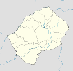
País Flag of Lesotho.svg Lesoto
Ubicación Coordenadas: 29°09′S 27°44′E / -29.15, 27.733
• Altitud 1711 msnm
Población 27071[1] hab. (est 2010)
Huso horario UTC+2

Teyateyaneng es la capital del distrito de Berea en Lesoto. Tiene una población de unos 75.115 habitantes (2005).

Contenido

Contexto geográfico

Se localiza a unos 40 km al norte de la capital nacional, Maseru, en la carretera Main North One, que corre paralela a la frontera sudafricana. La ciudad se encuentra situada en una meseta a unos 1.700 metros de altitud.

Historia

Fue fundada en 1886 como la capital de Berea por el jefe Masophal.

Demografía

Segun estimacion 2010 contaba con una población de 27.071 habitantes.[1]

Economía local

Teyaeteyaneng tiene comercios y fábricas textiles de alfombras.

Lugares de interés

Existe un hospital y tres institutos. Además, alrededor de la ciudad existen varias cuevas excavadas en la roca con pinturas de cazadores de la tribu San.

Referencias

Véase también

  • Anexo:Localidades de Lesoto

Wikimedia foundation. 2010.

Игры ⚽ Нужно решить контрольную?

Mira otros diccionarios:

  • Teyateyaneng — is a town located in the district of Berea in Lesotho. Teyateyaneng is also the camptown for the district of Berea. In 2005 it had a population of 75,115.GeographyTeyateyaneng is located about 40 kilometers north of the national capital of Maseru …   Wikipedia

  • Teyateyaneng — Administration Pays  Lesotho …   Wikipédia en Français

  • Teyateyaneng — 29.1527.75 Koordinaten: 29° 9′ S, 27° 45′ O …   Deutsch Wikipedia

  • Teyateyaneng — ▪ Lesotho       village, northwestern Lesotho, 19 miles (31 km) northeast of Maseru, on the country s main north south road. Named after the Teja Tejane (“Quicksands”) River that flows south of the village, Teyateyaneng is often abbreviated as TY …   Universalium

  • Teyateyaneng — Original name in latin Teyateyaneng Name in other language Teyateyaneng State code LS Continent/City Africa/Maseru longitude 29.14719 latitude 27.74895 altitude 1693 Population 5115 Date 2012 01 18 …   Cities with a population over 1000 database

  • Mofolo — Thomas Mokopu Mofolo (* 22. Dezember 1876 in Khojane bei Mafeteng in Basutoland, heute Lesotho; † 8. September 1948 in Teyateyaneng in Basutoland) war ein afrikanischer Schriftsteller. Leben Thomas Mofolo wurde als zweiter Sohn des christlichen… …   Deutsch Wikipedia

  • Blue Mountain Inn Lesotho — (Teyateyaneng,Лесото) Категория отеля: Адрес: Teyateyaneng, Police Statio …   Каталог отелей

  • Mokhehle — Ntsu Mokhehle (* 26. Dezember 1918 in Teyateyaneng, Basutoland; † 6. Januar 1999 in Bloemfontein, Südafrika) war ein bedeutender Politiker in Lesotho. Leben Ntsu Mokhehle gründete 1952, 14 Jahre vor der Unabhängigkeit des Landes, die Basutoland… …   Deutsch Wikipedia

  • Championnat du Lesotho de football — Infobox compétition sportive Lesotho Premier League Création 1970 Catégorie Division 1 Lieu …   Wikipédia en Français

  • Basutoland — Muso oa Lesotho (Sesotho) Kingdom of Lesotho (Englisch) Königreich Lesotho …   Deutsch Wikipedia

Compartir el artículo y extractos

Link directo
Do a right-click on the link above
and select “Copy Link”