Ajitwal

Ajitwal
Ajitwal
Localidad de la India
Ajitwal
Ajitwal
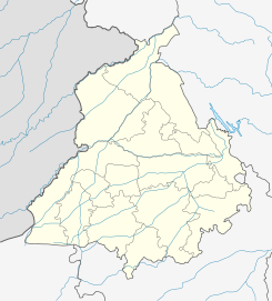
Ubicación de Ajitwal en Punyab.
30°20′05″N 74°47′21″E / 30.33472, 74.78917Coordenadas: 30°20′05″N 74°47′21″E / 30.33472, 74.78917
Entidad Localidad
 • País Bandera de India India
 • Estado Punyab
 • Distrito Moga
Altitud  
 • Media 208 msnm
Población (Est.2010[1] )  
 • Total 5.922 hab.
Huso horario IST UTC +5:30
PIN[2] 142053

Ajitwal es una ciudad de la India en el distrito de Moga, estado de Punyab.

Contenido

Geografía

Se encuentra a una altitud de 208 msnm a 249 km de la capital estatal, Chandigarh, en la zona horaria UTC +5:30.

Demografía

Según estimación 2010 contaba con una población de 5 922 habitantes.[1]

Referencias

Enlaces externos


Wikimedia foundation. 2010.

Игры ⚽ Поможем написать реферат

Mira otros diccionarios:

  • Ajitwal — Cleanup|date=September 2007Infobox City official name = Ajitwal native name = motto = imagesize = image caption = image mapsize = map caption = subdivision type = subdivision name = area magnitude = area total km2 = area total sq mi = area land… …   Wikipedia

  • Maddoke — Village Maddoke is situated between Moga and Jagraon, India, on an Ajitwal Badhni link road which is 7 km. from Ajitwal. The sixth Sikh Guru, Siri Guru Hargobind Sahib visited this historical village. In the memory of Siri Guru Hargobind Sahib, a …   Wikipedia

  • Dhudike — is a well known village in Moga district in the Indian state of Punjab. Contents 1 Geography 2 History 3 Educational institutes 4 Reference …   Wikipedia

  • Chuhar Chak —   village   …   Wikipedia

  • Moga district — This article is about the district. For its eponymous headquarters, see Moga, Punjab. Districts of Punjab along with their headquarters Moga district (Doabi:ਮੋਗਾ ਜ਼ਿਲਾ) is one of the Twenty districts in the state of Punjab in North West Republic… …   Wikipedia

  • Moga, Punjab — This article is about the municipality in Punjab, India. For its namesake district, see Moga district. Moga   city   …   Wikipedia

  • Dharamkot — Not to be confused with Dharamkot (Himachal Pradesh). Dharamkot   city (sub tehsil)   Coordinates Country India …   Wikipedia

  • Cheema Villages — This is a list of Cheema villages in East and West Punjab. Note: This is not a comprehensive list and also may have variant spellings of villages. Jogi Majra (Ludhiana District) Mohi (Ludhiana District) Dhuri (Ludhiana District) mullanpur… …   Wikipedia

  • Kokri Vehniwal(Moga) — Kokri vehniwal is a village situated about 18 km North East of the East Punjabi Moga District and 7 km from the Ludhiana Ferozepur Grand Trunk Road, near Ajitwal. The village has a population of approximately 3000, predominately Jatt Sikhs from… …   Wikipedia

  • Charik —   town   Coordinates Country India State Punjab nearest city = Moga …   Wikipedia

Compartir el artículo y extractos

Link directo
Do a right-click on the link above
and select “Copy Link”