Chabua

Chabua
Chabua
Localidad de la India
Chabua
Chabua
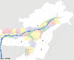
Ubicación de Chabua en Assam.
Ubicación de Assam en India.
27°28′57″N 95°10′25″E / 27.4825, 95.17361Coordenadas: 27°28′57″N 95°10′25″E / 27.4825, 95.17361
Entidad Localidad
 • País Bandera de India India
 • Estado Assam
 • Distrito Dibrugarh
Altitud  
 • Media 118 msnm
Población (Est.2010[1] )  
 • Total 31.668 hab.
Huso horario IST UTC +5:30
PIN[2] 786184
Código de área 37486

Chabua (en asamés: ) es una localidad de la India en el distrito de Dibrugarh, estado de Assam.

Contenido

Geografía

Se encuentra a una altitud de 118 msnm a 453 km de la capital estatal, Dispur, en la zona horaria UTC +5:30.

Demografía

Según estimación 2010 contaba con una población de 31 668 habitantes.[1]

Referencias

Enlaces externos


Wikimedia foundation. 2010.

Игры ⚽ Нужен реферат?

Mira otros diccionarios:

  • Chabua —   city   …   Wikipedia

  • Chabua — Original name in latin Chbua Name in other language Chabua, Chbua State code IN Continent/City Asia/Kolkata longitude 27.48253 latitude 95.17451 altitude 119 Population 7623 Date 2012 10 06 …   Cities with a population over 1000 database

  • Chabua Air Force Station — IAF Mig 21 IATA: none – ICAO: VECA …   Wikipedia

  • Chabua Amirejibi — Mzechabuk Chabua Amirejibi, (often written as Amiredjibi , Georgian: მზეჭაბუკ ჭაბუა ამირეჯიბი) (born November 18, 1921) is a Georgian novelist and Soviet era dissident notable for his magnum opus, Data Tutashkhia, and a lengthy experience in… …   Wikipedia

  • Chabua Air Force Base — Infobox Airport name = Chabua Air Force Base nativename = nativename a = nativename r = image width = caption = IATA = ICAO = VECA type = Military owner = operator = Indian Air Force city served = location = Chaba elevation f = 367 elevation m =… …   Wikipedia

  • Hagelberg — Gipfelkreuz auf dem Hagelberg (mit veralteter Höhenangabe) Höhe 200,24 m  …   Deutsch Wikipedia

  • Dibrugarh district — This article is about the district. For its eponymous headquarters, see Dibrugarh. Dibrugarh district   District   …   Wikipedia

  • Fläming — Der Fläming ist ein eiszeitlich gebildeter Höhenzug und gleichzeitig eine historisch gewachsene Kulturlandschaft im südwestlichen Brandenburg und östlichen Sachsen Anhalt. Er erstreckt sich östlich von Magdeburg über mehr als 100 Kilometer… …   Deutsch Wikipedia

  • Julie Christie — at the Guadalajara International Film Festival in 1997 Born Julie Frances Christie 14 April 1941 (1941 04 14) (age 7 …   Wikipedia

  • Gulag — For other uses, see Gulag (disambiguation). The integrated map of the Gulag camps, which existed from 1923 to 1961, based on data from the Human Rights Society «Memorial» …   Wikipedia

Compartir el artículo y extractos

Link directo
Do a right-click on the link above
and select “Copy Link”