Changlang

Changlang
Changlang
Localidad de la India
Changlang.jpg
Changlang  चांगलांग
Changlang
चांगलांग
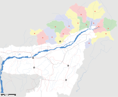
Ubicación de Changlang en Arunachal Pradesh.
Ubicación de Arunachal Pradesh en India.
27°45′27″N 96°37′25″E / 27.7575, 96.62361Coordenadas: 27°45′27″N 96°37′25″E / 27.7575, 96.62361
Entidad Localidad
 • País Bandera de India India
 • Estado Andhra Pradesh
 • Distrito Changlang
Altitud  
 • Media 1644 msnm
Población (Est.2010[1] )  
 • Total 7.781 hab.
Huso horario IST UTC +5:30
PIN[2] 792120
Código de área 3808

Changlang (en hindi:चांगलांग ) es una localidad de la India, centro administrativo del distrito de Changlang, estado de Arunachal Pradesh.

Contenido

Geografía

Se encuentra a una altitud de 1644 msnm a 595 km de la capital estatal, Itanagar, en la zona horaria UTC +5:30.

Demografía

Según estimación 2010 contaba con una población de 7 781 habitantes.[1]

Referencias

Enlaces externos


Wikimedia foundation. 2010.

Игры ⚽ Поможем написать курсовую

Mira otros diccionarios:

  • Changlang — This article is about the municipality in India. For its namesake district, see Changlang district. Changlang   town   …   Wikipedia

  • Changlang Resort — (Pak Meng,Таиланд) Категория отеля: 1 звездочный отель Адрес: 131/1 Moo 5, Maifad …   Каталог отелей

  • Changlang district — This article is about the district. For its eponymous headquarters, see Changlang. Changlang district Lo …   Wikipedia

  • Miao, Changlang — For other uses, see Miao (disambiguation). Miao, Changlang   town   …   Wikipedia

  • District de Changlang — Le district de Changlang en noir Changlang est un des 16 districts de l Arunachal Pradesh. Sa population était de 125 422 habitants en 2001 et de 95 530 habitants en 1991. Il s étend sur 4 662 km². Son chef lieu est la ville… …   Wikipédia en Français

  • Arunachal Pradesh — Arunachal redirects here. For the hill at Thiruvannamalai, see Arunachala. Arunachal Pradesh अरुणाचल प्रदेश   State   …   Wikipedia

  • Ledo Road — The Ledo Road, (from Ledo, Assam, India to Kunming, Yunnan, China) was built during World War II so that the Western Allies could supply the Chinese as an alternative to the Burma Road which had been cut by the Japanese in 1942. It was renamed… …   Wikipedia

  • Districts of Arunachal Pradesh — Contents 1 History 2 Administrative set up 3 Districts 4 Notes History On December 1, 1965 the erstwhile North East Frontier Agency …   Wikipedia

  • Lake of No Return — Infobox lake lake name = Lake of No Return image lake = Lake of No Return.jpg] caption lake = image bathymetry = caption bathymetry = location = coords = type = inflow = outflow = catchment = basin countries = Burma length = width = area = depth …   Wikipedia

  • Bordumsa — is a town in the Changlang district of Arunachal Pradesh, India. The Singpho tribe are the original inhabitants of the area. Bordumsa s population is 25,368 and its elevation is 150 meters. [ [http://changlang.nic.in/howto.html#bordumsa A Profile …   Wikipedia

Compartir el artículo y extractos

Link directo
Do a right-click on the link above
and select “Copy Link”