Chapel and Hill Chorlton

Chapel and Hill Chorlton
Parroquia civil del Reino Unido
Chapel and Hill Chorlton
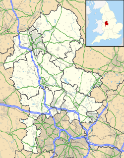
Ubicación de Chapel and Hill Chorlton en Staffordshire.
52°56′35.9″N 2°17′30.4″O / 52.943306, -2.291778Coordenadas: 52°56′35.9″N 2°17′30.4″O / 52.943306, -2.291778
Entidad Parroquia civil
 • País Bandera del Reino Unido Reino Unido
 • Nación constitutiva Inglaterra
 • Región Midlands del Oeste
 • Condado Staffordshire
 • Distrito Newcastle-under-Lyme
Superficie  
 • Total 7,06 km²
Población (2001)  
 • Total 402 hab.
 • Densidad 56,94 hab/km²
Huso horario GMT (UTC0)
 • en verano BST (UTC +1)

Chapel and Hill Chorlton es una parroquia civil del distrito de Newcastle-under-Lyme, en el condado de Staffordshire (Inglaterra).

Geografía

Según la Oficina Nacional de Estadística británica, Chapel and Hill Chorlton tiene una superficie de 7,06 km².[1]

Demografía

Según el censo de 2001, Chapel and Hill Chorlton tenía 402 habitantes (53,48% varones, 46,52% mujeres) y una densidad de población de 56,94 hab/km². El 14,93% eran menores de 16 años, el 76,37% tenían entre 16 y 74, y el 8,71% eran mayores de 74. La media de edad era de 43,51 años. Del total de habitantes con 16 o más años, el 21,64% estaban solteros, el 64,33% casados, y el 14,04% divorciados o viudos.[2]

Según su grupo étnico, el 98,25% de los habitantes eran blancos, el 0,75% mestizos, y el 1% asiáticos. La mayor parte (96,53%) eran originarios del Reino Unido. El resto de países europeos englobaban al 1,49% de la población, mientras que el 1,99% había nacido en cualquier otro lugar. El cristianismo era profesado por el 82,46% y el sijismo por el 1%, mientras que el 7,77% no eran religiosos y el 8,77% no marcaron ninguna opción en el censo.[1]

Había 177 hogares con residentes y 4 vacíos.[2]

Referencias

  1. a b Tablas: «Usual Resident Population (KS01) for Amalgamated Parishes», «Ethnic Group (KS06) for Amalgamated Parishes», «Country of Birth (KS05) for Amalgamated Parishes» y «Religion (KS07) for Amalgamated Parishes», disponibles para descarga aquí. Office for National Statistics (inglés).
  2. a b «Area: Chapel and Hill Chorlton CP (Parish)» (en inglés). Office for National Statistics. Consultado el 12 de septiembre de 2011.

Wikimedia foundation. 2010.

Игры ⚽ Нужна курсовая?

Mira otros diccionarios:

  • Chorlton — may refer to: Places Chorlton cum Hardy, in Manchester, England Chorlton on Medlock, in Manchester, England Chorlton, Chester, in the district of Cheshire West and Chester, England Chorlton, Cheshire East, in Cheshire, England Chapel and Hill… …   Wikipedia

  • Chorlton-cum-Hardy — Not to be confused with Chorlton on Medlock. Coordinates: 53°26′31″N 2°16′37″W / 53.442°N 2.277°W / 53.442; 2.277 …   Wikipedia

  • Chorlton-on-Medlock — Not to be confused with Chorlton cum Hardy. Coordinates: 53°28′00″N 2°13′00″W / 53.466667°N 2.216667°W / 53.466667; 2.21 …   Wikipedia

  • Dunham on the Hill, Cheshire — Coordinates: 53°14′53″N 2°48′04″W / 53.248°N 2.801°W / 53.248; 2.801 Dunham on the Hill is a village and …   Wikipedia

  • List of District Health Authorities in England and Wales — District Health Authorities were administrative units of the National Health Service in England and Wales from 1982 to 1996. The districts were a second tier below the health regions. They replaced the Area Health Authorities (which generally… …   Wikipedia

  • List of civil parishes in Staffordshire — This is a list of civil parishes in Staffordshire, England. Stoke on Trent is included in this list (though it is entirely unparished). =Cannock Chase= Cannock is unparished.* Brereton and Ravenhill * Bridgtown * Brindley Heath * Cannock Wood *… …   Wikipedia

  • Newcastle-under-Lyme Rural District — Geography Status Rural district 1901 area 20,005 acres (80.96 km2) 1961 area 40,017 acres (161.94 km2) …   Wikipedia

  • Manchester — This article is about the city of Manchester in England. For the wider metropolitan county, see Greater Manchester. For the larger conurbation, see Greater Manchester Urban Area. For other uses, see Manchester (disambiguation). Coordinates …   Wikipedia

  • Cholmondeley, Cheshire — Coordinates: 53°03′26″N 2°41′30″W / 53.057088°N 2.691637°W / 53.057088; 2.691637 …   Wikipedia

  • Sandbach — Coordinates: 53°08′46″N 2°22′01″W / 53.146°N 2.367°W / 53.146; 2.367 …   Wikipedia

Compartir el artículo y extractos

Link directo
Do a right-click on the link above
and select “Copy Link”