- Cherry Tree (Oklahoma)
-
Cherry Tree Lugar designado por el censo de los Estados Unidos Ubicación en el condado de Adair en Oklahoma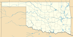
 Cherry Tree
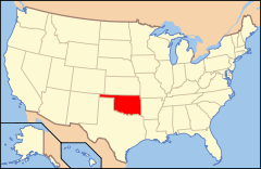
Ubicación de Oklahoma en EE. UU.Coordenadas: Entidad Lugar designado por el censo • País  Estados Unidos
• Estado  Oklahoma
• Condado Adair Fundación 11 de marzo de 2008 Superficie • Total 29,9 km² • Tierra 29,8 km² • Agua 0,1 km² Altitud • Media 317 msnm Población (2010) • Total 883 hab. • Densidad 29,53 hab/km² Huso horario Centro: UTC-6 • en verano UTC-5 Código ZIP 74960 Código de área 539/918 Cherry Tree es un lugar designado por el censo ubicado en el condado de Adair en el estado estadounidense de Oklahoma. En el año 2010 tenía una población de 883 habitantes y una densidad poblacional de 29,53 personas por km².[1]
Contenido
Geografía
Cherry Tree se encuentra ubicado en las coordenadas (35.746465° -94.643925°)[2] . Según la Oficina del Censo de los Estados Unidos, Cherry Tree tiene una superficie total de 11,56 mi² (29,9 km²), de la cual 11,506 mi² (29,8 km²) corresponden a tierra firme y 0,054 mi² (0,1 km²) es agua.[3]
Demografía
Según la Oficina del Censo en 2000 los ingresos medios por hogar en la localidad eran de $26,438 y los ingresos medios por familia eran $28,882. Los hombres tenían unos ingresos medios de $25,417 frente a los $18,295 para las mujeres. La renta per cápita para la localidad era de $8,895. Alrededor del 26.5% de la población estaban por debajo del umbral de pobreza.[2]
Referencias
- ↑ «Encuentra un condado» (en inglés). Asociación Nacional de Condados (11 de julio de 2011). Consultado el 11 de julio de 2011.
- ↑ a b «American FactFinder» (en inglés). Oficina del Censo de los Estados Unidos. Consultado el 11 de julio de 2011.
- ↑ «US Board on Geographic Names» (en inglés). Servicio Geológico de los Estados Unidos (25 de octubre de 2007). Consultado el 11 de julio de 2011.
Enlaces externos
 Portal:Oklahoma. Contenido relacionado con Oklahoma.
 Wikimedia Commons alberga contenido multimedia sobre Cherry Tree (Oklahoma). Commons
Categorías:- Lugares designados por el censo en Oklahoma
- Localidades del condado de Adair (Oklahoma)


Wikimedia foundation. 2010.