City Line (Brooklyn)

City Line (Brooklyn)
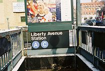
Estación de la avenida Liberty.
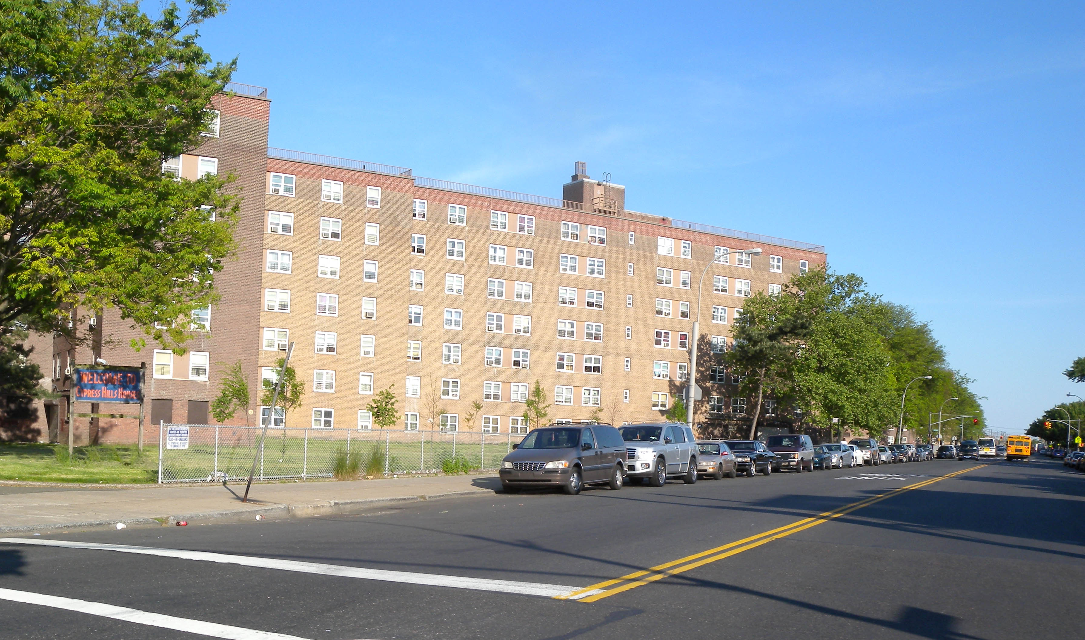
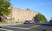
Edificios de apartamentos en Cypress Hills.

City Line es una subsección del barrio de East New York en el distrito de Brooklyn en Nueva York, bordeando los barrios de Cypress Hills al norte y Ozone Park en Queens al este, y Shore Parkway al sur. El barrio es nombrado "City Line" por su ubicación en la antigua ciudad de Brooklyn, cerca de la frontera del condado de Queens.[1]

City Line es uno de los barrios con mayor diversidad étnica en Brooklyn. Muchos italianos e irlandeses vivían originalmente en la zona, que hoy es el hogar de inmigrantes de Bangladesh, República Dominicana, Guyana y Puerto Rico.[2]

City Line cuenta con las líneas de metro A y C of de la IND. El principal distrito comercial se encuentra a lo largo de la avenida de la Libertad. El barrio es parte del Brooklyn Community Board 5.

Viviendas subvencionadas

Las Cypress Hills Houses contienen 15 edficios de siete plantas con 1.442 apartamentos, ubicados entre Linden Boulevard y la avenidas Sutter, Euclid y Fountain. El complejo de viviendas fue terminado en 1955 y pertenece a la New York City Housing Authority.[3]

El desarollo residencial de East New York City Line está también en manos de la New York City Housing Authority y contiene 33 apartamentos de tres plantas con 63 viviendas. Los apartamentos están situados justo al oeste de las Cypress Hills Houses y fueron completados en 1976.[4]

Referencias

  1. Liff, Bob. «Where City Drew the Line Double Lives the Norm in Border Nabe», 27-04-1999. Consultado el 22-08-2009.
  2. Hays, Elizabeth. «Thriving City Line Draws Hard Workers», 09-03-2003. Consultado el 22-08-2009.
  3. «Cypress Hills Houses». New York City Housing Authority. Consultado el 22-08-2009.
  4. «East New York City Line». New York City Housing Authority. Consultado el 22-08-2009.

Wikimedia foundation. 2010.

Игры ⚽ Нужен реферат?

Mira otros diccionarios:

  • City Line, Brooklyn — Liberty Avenue in City Line, Brooklyn NY City Line is a sub section of the East New York neighborhood in Brooklyn, New York City, bordering the neighborhoods of Cypress Hills to the north and Ozone Park, Queens to the east, and the Shore Parkway… …   Wikipedia

  • City Line — may refer to: city limit Sweden The Stockholm City Line, railway tunnel currently under construction beneath central Stockholm, Sweden United Kingdom The Cardiff City Line, commuter rail route for Cardiff, Wales The Waterloo and City Underground… …   Wikipedia

  • West End Line (Brooklyn surface) — The West End Line or New Utrecht Avenue Line was a surface transit line in Brooklyn, New York City, United States, running along New Utrecht Avenue and other streets between Coney Island and Sunset Park. Built by the Brooklyn, Bath and Coney… …   Wikipedia

  • Grand Street Line (Brooklyn) — The Grand Street Line is a public transit line in Brooklyn and Queens, New York City, United States, running mostly along Grand Street/Grand Avenue between Williamsburg, Brooklyn and Maspeth, Queens. Originally a streetcar line, it is now the Q59 …   Wikipedia

  • Fifth Avenue Line (Brooklyn surface) — The Fifth Avenue Line is a public transit line in Brooklyn, New York City, United States, running mainly along Fifth Avenue and Atlantic Avenue between Fort Hamilton and Cobble Hill. Originally a streetcar line, it is now the B63 Fifth/Atlantic… …   Wikipedia

  • Fifth Avenue Line (Brooklyn elevated) — The Fifth Avenue Line or Fifth Avenue Bay Ridge Line was an elevated rail line in Brooklyn, New York City, United States. It ran above Hudson Avenue, Flatbush Avenue, Fifth Avenue, 38th Street, and Third Avenue from Downtown Brooklyn south to Bay …   Wikipedia

  • Brooklyn Bridge — – City Hall / Chambers Street …   Wikipedia

  • Crosstown Line (Brooklyn surface) — The Crosstown Line is a public transit line in Brooklyn, New York City, United States, running along Van Brunt Street and Manhattan Avenue between Red Hook and Long Island City, Queens. Originally a streetcar line, it is now the B61 and the B62… …   Wikipedia

  • Union Avenue Line (Brooklyn) — The Union Avenue Line was a public transit line in Brooklyn, New York City, United States, running mostly along Myrtle Avenue, Knickerbocker Avenue, Flushing Avenue, Throop Avenue, and Union Avenue from Ridgewood, Queens northwest to Greenpoint,… …   Wikipedia

  • Brooklyn Community Board — Brooklyn Community Boards comprise eighteen local units in the borough of Brooklyn, which, like those in the other boroughs, play a role in the government of New York City.CB 1Brooklyn Community Board 1 encompasses Flushing Avenue, Williamsburg,… …   Wikipedia

Compartir el artículo y extractos

Link directo
Do a right-click on the link above
and select “Copy Link”