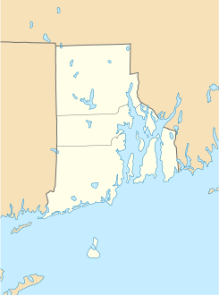
Clayville (Rhode Island)

Clayville (Rhode Island)
Clayville
Lugar designado por el censo de los Estados Unidos
Clayville
Clayville
Ubicación en el condado de Providence en Rhode Island
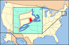
Ubicación de Rhode Island en EE. UU.
41°45′45.31″N 71°41′13.83″O / 41.7625861, -71.687175Coordenadas: 41°45′45.31″N 71°41′13.83″O / 41.7625861, -71.687175
Entidad Lugar designado por el censo
 • País Bandera de los Estados Unidos Estados Unidos
 • Estado Flag of Rhode Island.svg Rhode Island
 • Condado Providence
Fundación 21 de junio de 2010
Altitud  
 • Media 140 msnm
Población (2010)  
 • Total 300 hab.
Huso horario Pacífico: UTC-8
 • en verano UTC-7
Código ZIP 02825

Clayville es un lugar designado por el censo ubicado en el condado de Providence en el estado estadounidense de Rhode Island. En el año 2010 tenía una población de 300 habitantes.[1]

Geografía

Clayville se encuentra ubicado en las coordenadas 41°45′45.31″N 71°41′13.83″O / 41.7625861, -71.687175Coordenadas: 41°45′45.31″N 71°41′13.83″O / 41.7625861, -71.687175.[2]

Referencias

  1. «Encuentra un condado» (en inglés). Asociación Nacional de Condados (11 de julio de 2011). Consultado el 11 de julio de 2011.
  2. «American FactFinder» (en inglés). Oficina del Censo de los Estados Unidos. Consultado el 11 de julio de 2011.

Enlaces externos


Wikimedia foundation. 2010.

Игры ⚽ Поможем написать курсовую

Mira otros diccionarios:

  • Scituate, Rhode Island — Infobox Settlement official name = Scituate, Rhode Island settlement type = Town nickname = motto = imagesize = image caption = image mapsize = 250px map caption = Location of Scituate in Rhode Island mapsize1 = map caption1 = subdivision type =… …   Wikipedia

  • Foster, Rhode Island — Infobox Settlement official name = Foster, Rhode Island settlement type = Town nickname = motto = imagesize = image caption = image mapsize = 250px map caption = Location of Foster in Rhode Island mapsize1 = map caption1 = subdivision type =… …   Wikipedia

  • Foster (Rhode Island) — Foster …   Deutsch Wikipedia

  • Foster (Rhode Island) — 41°51′13″N 71°45′29″O / 41.85361, 71.75806 …   Wikipédia en Français

  • National Register of Historic Places listings in Providence County, Rhode Island — Location of Providence County in Rhode Island This is a list of the National Register of Historic Places listings in Providence County, Rhode Island. This is intended to be a complete list of the properties and districts on the National Register… …   Wikipedia

  • Clayville — ist der Name mehrerer Orte in den Vereinigten Staaten: Clayville (Connecticut) Clayville (New Jersey) Clayville (New York) Clayville (Rhode Island) Clayville (Virginia) Diese Seite ist eine Begriffsklärung zur Unterscheidung mehrerer mit …   Deutsch Wikipedia

  • Clayville Historic District — U.S. National Register of Historic Places U.S. Historic district …   Wikipedia

  • WNRI — Infobox Radio station name = WNRI city = Woonsocket, Rhode Island area = Northern Rhode Island, Southern Massachusetts branding = News/Talk 1380 WNRI slogan = Serving the Blackstone Valley since 1954 airdate = November 28, 1954 frequency = 1380… …   Wikipedia

  • National Register of Historic Places listings in Sangamon County, Illinois — See also: National Register of Historic Places listings in Illinois Contents: List of properties on the National Register of Historic Places in Sangamon County, Illinois, USA: This National Park Service list is complete through NPS recent… …   Wikipedia

  • National Register of Historic Places listings in Powhatan County, Virginia — Map of all coordinates from Google Map of all coordinates from Bing …   Wikipedia

Compartir el artículo y extractos

Link directo
Do a right-click on the link above
and select “Copy Link”