Conning Towers-Nautilus Park

Conning Towers-Nautilus Park
Lugar designado por el censo de los Estados Unidos
Conning Towers-Nautilus Park
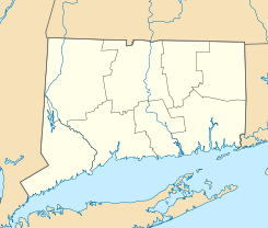
Ubicación en el condado de New London en el estado de Connecticut
Map of USA CT.svg
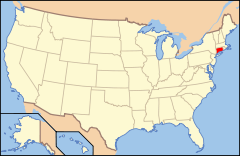
Ubicación de Connecticut en EE. UU.
41°43′0″N 72°13′0″O / 41.71667, -72.21667Coordenadas: 41°43′0″N 72°13′0″O / 41.71667, -72.21667
Entidad Lugar designado por el censo
 • País Bandera de los Estados Unidos Estados Unidos
 • Estado Bandera de Connecticut Connecticut
 • Condado New London
Superficie  
 • Total 14,5 km²
 • Tierra 12,9 km²
 • Agua (10,91%) 1,6 km²
Población (2000)  
 • Total 10.241 hab.
 • Densidad 706 hab/km²
Huso horario Este: UTC-5
 • en verano UTC-4

Conning Towers-Nautilus Park es un lugar designado por el censo ubicado en el condado de New London en el estado estadounidense de Connecticut. En el año 2000 tenía una población de 10,241 habitantes y una densidad poblacional de 706 personas por km².[1]

Contenido

Geografía

Conning Towers-Nautilus Park se encuentra ubicado en las coordenadas 41°43′0″N 72°13′0″O / 41.71667, -72.21667Coordenadas: 41°43′0″N 72°13′0″O / 41.71667, -72.21667.[2]

Demografía

Según la Oficina del Censo en 2000 los ingresos medios por hogar en la localidad eran de $40,033 y los ingresos medios por familia eran $38,043. Los hombres tenían unos ingresos medios de $29,297 frente a los $25,280 para las mujeres. La renta per cápita para la localidad era de $14,216. Alrededor del 4.7% de la población estaban por debajo del umbral de pobreza.[3]

Referencias

  1. «Encuentra un condado» (en inglés). Asociación Nacional de Condados (11 de julio de 2011). Consultado el 11 de julio de 2011.
  2. «American FactFinder» (en inglés). Oficina del Censo de los Estados Unidos. Consultado el 11 de julio de 2011.
  3. «U.S. Gazetteer: Censo de 2010» (en inglés). Oficina del Censo de los Estados Unidos (16 de febrero de 2011). Consultado el 11 de julio de 2011.

Enlaces externos


Wikimedia foundation. 2010.

Игры ⚽ Поможем написать курсовую

Mira otros diccionarios:

  • Conning Towers-Nautilus Park — Conning Towers Nautilus Park, CT U.S. Census Designated Place in Connecticut Population (2000): 10241 Housing Units (2000): 2822 Land area (2000): 4.983105 sq. miles (12.906182 sq. km) Water area (2000): 0.611310 sq. miles (1.583286 sq. km) Total …   StarDict's U.S. Gazetteer Places

  • Conning Towers-Nautilus Park, CT — U.S. Census Designated Place in Connecticut Population (2000): 10241 Housing Units (2000): 2822 Land area (2000): 4.983105 sq. miles (12.906182 sq. km) Water area (2000): 0.611310 sq. miles (1.583286 sq. km) Total area (2000): 5.594415 sq. miles… …   StarDict's U.S. Gazetteer Places

  • Conning Towers-Nautilus Park — is a census designated place (CDP) in New London County, Connecticut, United States. The population was 10,241 at the 2000 census.GeographyAccording to the United States Census Bureau, the CDP has a total area of 14.5 km² (5.6 mi²). 12.9 km² (5.0 …   Wikipedia

  • Conning Towers-Nautilus Park — Original name in latin Conning Towers Nautilus Park Name in other language State code US Continent/City America/New York longitude 41.38548 latitude 72.06877 altitude 70 Population 8834 Date 2011 05 14 …   Cities with a population over 1000 database

  • Conning Towers-Nautilus Park, Connecticut — Conning Towers Nautilus Park is a census designated place (CDP) in the town of Groton in New London County, Connecticut, United States. The population was 10,241 at the 2000 census. The statistical area consists of the portion of the town in the… …   Wikipedia

  • Conning Towers — Nautilus Park, CT U.S. Census Designated Place in Connecticut Population (2000): 10241 Housing Units (2000): 2822 Land area (2000): 4.983105 sq. miles (12.906182 sq. km) Water area (2000): 0.611310 sq. miles (1.583286 sq. km) Total area (2000): 5 …   StarDict's U.S. Gazetteer Places

  • Conning Towers, CT — Conning Towers Nautilus Park, CT U.S. Census Designated Place in Connecticut Population (2000): 10241 Housing Units (2000): 2822 Land area (2000): 4.983105 sq. miles (12.906182 sq. km) Water area (2000): 0.611310 sq. miles (1.583286 sq. km) Total …   StarDict's U.S. Gazetteer Places

  • National Register of Historic Places listings in New London County, Connecticut — Location of New London County in Connecticut This is a list of the National Register of Historic Places listings in New London County, Connecticut. This is intended to be a complete list of the properties and districts on the National Register of …   Wikipedia

  • Neighborhoods of Norwich, Connecticut — Harbor view, 1909 …   Wikipedia

  • Groton, Connecticut — This article is about the Town of Groton. For the City of Groton located within the town, see Groton, Connecticut (city). Groton, Connecticut …   Wikipedia

Compartir el artículo y extractos

Link directo
Do a right-click on the link above
and select “Copy Link”