Gowanda

Gowanda
Gowanda
Villa de los Estados Unidos
Gowanda
Gowanda
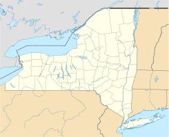
Ubicación en el condado de Cattaraugus y en el estado de Nueva York
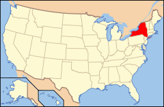
Map of USA NY.svg
Ubicación de Nueva York en EE. UU.
42°27′48″N 78°56′11″O / 42.46333, -78.93639Coordenadas: 42°27′48″N 78°56′11″O / 42.46333, -78.93639
Entidad Villa
 • País Bandera de los Estados Unidos Estados Unidos
 • Estado Flag of New York.svg Nueva York
 • Condado Cattaraugus
Superficie  
 • Total 4,2 km²
 • Tierra 4,2 km²
 • Agua (0%) 0 km²
Altitud  
 • Media 232 msnm
Población (2000)  
 • Total 2.842 hab.
 • Densidad 677 hab/km²
Huso horario Este: UTC-5
 • en verano UTC-4
Código ZIP 14070
Código de área 716

Gowanda es una villa ubicada en el condado de Cattaraugus en el estado estadounidense de Nueva York. En el año 2000 tenía una población de 2,842 habitantes y una densidad poblacional de 677 personas por km².

Contenido

Geografía

Gowanda se encuentra ubicada en las coordenadas 42°27′48″N 78°56′11″O / 42.46333, -78.93639.[1]

Demografía

Según la Oficina del Censo en 2000 los ingresos medios por hogar en la localidad eran de $29,565, y los ingresos medios por familia eran $39,094. Los hombres tenían unos ingresos medios de $32,279 frente a los $25,281 para las mujeres. La renta per cápita para la localidad era de $16,323. Alrededor del 14.4% de la población estaban por debajo del umbral de pobreza.[2]

Referencias

  1. «U.S. Gazetteer: Censo de 2010» (en inglés). Oficina del Censo de los Estados Unidos (16 de febrero de 2011). Consultado el 11 de julio de 2011.
  2. «American FactFinder» (en inglés). Oficina del Censo de los Estados Unidos. Consultado el 11 de julio de 2011.

Enlaces externos


Wikimedia foundation. 2010.

Игры ⚽ Поможем написать курсовую

Mira otros diccionarios:

  • Gowanda — Gowanda, NY U.S. village in New York Population (2000): 2842 Housing Units (2000): 1277 Land area (2000): 1.603528 sq. miles (4.153117 sq. km) Water area (2000): 0.011318 sq. miles (0.029313 sq. km) Total area (2000): 1.614846 sq. miles (4.182430 …   StarDict's U.S. Gazetteer Places

  • Gowanda, NY — U.S. village in New York Population (2000): 2842 Housing Units (2000): 1277 Land area (2000): 1.603528 sq. miles (4.153117 sq. km) Water area (2000): 0.011318 sq. miles (0.029313 sq. km) Total area (2000): 1.614846 sq. miles (4.182430 sq. km)… …   StarDict's U.S. Gazetteer Places

  • Gowanda — Original name in latin Gowanda Name in other language State code US Continent/City America/New York longitude 42.46312 latitude 78.93587 altitude 235 Population 2709 Date 2011 05 14 …   Cities with a population over 1000 database

  • Gowanda, New York — Infobox Settlement official name = Gowanda, New York settlement type = Village nickname = motto = imagesize = image caption = image |pushpin pushpin label position = pushpin map caption =Location within the state of New York pushpin mapsize =… …   Wikipedia

  • Gowanda Correctional Facility — The Gowanda Correctional Facility is a medium security prison for males located in New York, United States. The prison is located in the south part of Erie County in the Town of Collins. It is co located with the Collins Correctional Facility,… …   Wikipedia

  • 14070 — Gowanda, Ny (Miscellaneous » ZIP Codes) …   Abbreviations dictionary

  • New York State Route 438 — NYS Route 438 Map of western New York with NY 438 highlighted in red Route information …   Wikipedia

  • New York State Route 39 — NY 39 redirects here. NY 39 may also refer to New York s 39th congressional district. This article is about the current alignment of NY 39. For the former alignment of NY 39 in Dutchess and Putnam Counties, see New York State Route 39… …   Wikipedia

  • National Register of Historic Places listings in Cattaraugus County, New York — Location of Cattaraugus County in New York …   Wikipedia

  • Collins, New York — Coordinates: 42°29′47″N 78°55′14″W / 42.49639°N 78.92056°W / 42.49639; 78.92056 …   Wikipedia

Compartir el artículo y extractos

Link directo
Do a right-click on the link above
and select “Copy Link”