Greensboro Bend

Greensboro Bend
Greensboro Bend
Lugar designado por el censo de los Estados Unidos
Greensboro Bend
Greensboro Bend
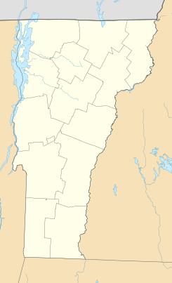
Ubicación en el condado de Orleans en Vermont
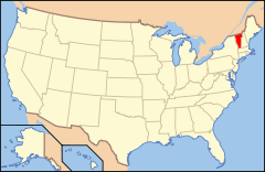
Ubicación de Vermont en EE. UU.
44°32′50″N 72°15′48″O / 44.54722, -72.26333Coordenadas: 44°32′50″N 72°15′48″O / 44.54722, -72.26333
Entidad Lugar designado por el censo
 • País Bandera de los Estados Unidos Estados Unidos
 • Estado Flag of Vermont.svg Vermont
 • Condado Orleans
Fundación 10 de junio de 2010
Altitud  
 • Media 351 msnm
Población (2010)  
 • Total 232 hab.
Huso horario Este: UTC-5
 • en verano UTC-4
Código ZIP 05842
Código de área 802

Greensboro Bend es un lugar designado por el censo ubicado en el condado de Orleans en el estado estadounidense de Vermont. En el año 2010 tenía una población de 232 habitantes.[1]

Geografía

Greensboro Bend se encuentra ubicado en las coordenadas 44°32′50″N 72°15′48″O / 44.54722, -72.26333Coordenadas: 44°32′50″N 72°15′48″O / 44.54722, -72.26333.[2]

Referencias

  1. «Encuentra un condado» (en inglés). Asociación Nacional de Condados (11 de julio de 2011). Consultado el 11 de julio de 2011.
  2. «U.S. Gazetteer: Censo de 2010» (en inglés). Oficina del Censo de los Estados Unidos (16 de febrero de 2011). Consultado el 11 de julio de 2011.

Enlaces externos


Wikimedia foundation. 2010.

Игры ⚽ Нужен реферат?

Mira otros diccionarios:

  • Greensboro, Vermont — Infobox Settlement official name = Pagename other name = native name = nickname = settlement type = Town motto = imagesize = image caption = flag size = image seal size = image shield = shield size = image blank emblem = blank emblem size =… …   Wikipedia

  • 05842 — Greensboro Bend, Vt (Miscellaneous » ZIP Codes) …   Abbreviations dictionary

  • Bahnstrecke Lunenburg–Maquam — Lunenburg VT– Maquam VT[1][2][3] Streckenlänge: 193,7 km Spurweite: 1435 mm (Normalspur) Legende …   Deutsch Wikipedia

  • National Register of Historic Places listings in Orleans County, Vermont — Location of Orleans County in Vermont This is a list of the National Register of Historic Places listings in Orleans County, Vermont. This is intended to be a complete list of the properties and districts on the National Register of Historic… …   Wikipedia

  • Vermont Route 16 — Infobox road state=VT type=VT route=16 length mi=27.890 length round=2 length ref= established=By 1967 direction a=South starting terminus= junction= direction b=North ending terminus= counties=Caledonia, Orleans previous type=VT previous… …   Wikipedia

  • Condado de Orleans (Vermont) — Para otros usos de este término, véase Condado de Orleans. Condado de Orleans Condado de los Estados Unidos …   Wikipedia Español

  • Conversion of St. Paul Church (Vermont) — In 1893, the Conversion of St. Paul Roman Catholic Church was founded in Barton, Vermont, USA. The parish is under the guidance of the Roman Catholic Diocese of Burlington. The church is usually called St. Paul s by parishioners. Contents 1… …   Wikipedia

  • St. Johnsbury and Lamoille County Railroad — (StJ LC) was constructed in the 1870 s as the Vermont Division of the Portland and Ogdensburg Railway to connect the Great Lakes with the seaport of Portland, Maine. The westerly connection with the Great Lakes was never made. The eastern end of… …   Wikipedia

  • Methodist Episcopal Church (Stannard, Vermont) — Methodist Episcopal Church U.S. National Register of Historic Places …   Wikipedia

  • Rural Studio — The Rural Studio is a design build architecture studio run by Auburn University which aims to teach students about the social responsibilities of the profession of architecture while also providing safe, well constructed and inspirational homes… …   Wikipedia

Compartir el artículo y extractos

Link directo
Do a right-click on the link above
and select “Copy Link”