- Gudiyatham
-
Gudiyatham Localidad de la India Ubicación de Gudiyatham en Tamil Nadu.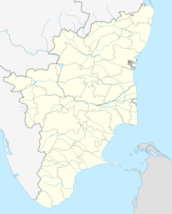
 Gudiyatham
குடியாத்தம்
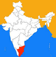
Ubicación de Tamil Nadu en India.Coordenadas: Entidad Localidad • País  India
India• Estado Tamil Nadu • Distrito Vellore Altitud • Media 281 msnm Población (Est.2010[1] ) • Total 96.782 hab. Huso horario IST UTC +5:30 PIN 632 601, 632 602 Código de área +91 4171 Gudiyatham (en tamil: குடியாத்தம் ) es una localidad de la India en el distrito de Vellore, estado de Tamil Nadu.
Geografía
Se encuentra a una altitud de 281 msnm a 150 km de la capital estatal, Chennai, en la zona horaria UTC +5:30.
Demografía
Según estimación 2010 contaba con una población de 96 782 habitantes.[1]
Referencias
Categoría:- Localidades de Tamil Nadu

Wikimedia foundation. 2010.