Harvey Cedars

Harvey Cedars
Harvey Cedars
Borough de los Estados Unidos
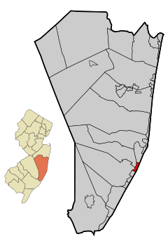
Ubicación en el condado de Ocean en Nueva JerseyUbicación de Nueva Jersey en EE. UU.
Ubicación en el condado de Ocean en Nueva Jersey
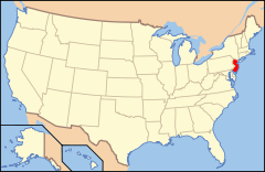
Map of USA NJ.svg
Ubicación de Nueva Jersey en EE. UU.
Entidad Borough
 • País Bandera de los Estados Unidos Estados Unidos
 • Estado Bandera de Nueva Jersey Nueva Jersey
 • Condado Ocean
Superficie  
 • Total 3,1 km²
 • Tierra 1,4 km²
 • Agua (54,62%) 1,7 km²
Altitud  
 • Media 19 msnm
Población (2010)  
 • Total 337 hab.
 • Densidad 108,71 hab/km²
Huso horario Este: UTC-5
 • en verano UTC-4
Código ZIP 08008
Código de área 609

Harvey Cedars es un borough ubicado en el condado de Ocean en el estado estadounidense de Nueva Jersey. En el año 2010 tenía una población de 337 habitantes y una densidad poblacional de 108 personas por km².[1]

Contenido

Geografía

Harvey Cedars se encuentra ubicado en las coordenadas 39°42′02″N 74°08′18″O / 39.70056, -74.13833Coordenadas: 39°42′02″N 74°08′18″O / 39.70056, -74.13833.[2]

Demografía

Según la Oficina del Censo en 2000 los ingresos medios por hogar en la localidad eran de $61,875 y los ingresos medios por familia eran $69,722. Los hombres tenían unos ingresos medios de $71,042 frente a los $32,361 para las mujeres. La renta per cápita para la localidad era de $36,757. Alrededor del 5.1% de la población estaba por debajo del umbral de pobreza.[3]

Referencias

  1. «Encuentra un condado» (en inglés). Asociación Nacional de Condados (11 de julio de 2011). Consultado el 11 de julio de 2011.
  2. «American FactFinder» (en inglés). Oficina del Censo de los Estados Unidos. Consultado el 11 de julio de 2011.
  3. «U.S. Gazetteer: Censo de 2010» (en inglés). Oficina del Censo de los Estados Unidos (16 de febrero de 2011). Consultado el 11 de julio de 2011.

Enlaces externos


Wikimedia foundation. 2010.

Игры ⚽ Поможем написать реферат

Mira otros diccionarios:

  • Harvey Cedars — Harvey Cedars, NJ U.S. borough in New Jersey Population (2000): 359 Housing Units (2000): 1205 Land area (2000): 0.546334 sq. miles (1.414999 sq. km) Water area (2000): 0.646713 sq. miles (1.674979 sq. km) Total area (2000): 1.193047 sq. miles (3 …   StarDict's U.S. Gazetteer Places

  • Harvey Cedars, NJ — U.S. borough in New Jersey Population (2000): 359 Housing Units (2000): 1205 Land area (2000): 0.546334 sq. miles (1.414999 sq. km) Water area (2000): 0.646713 sq. miles (1.674979 sq. km) Total area (2000): 1.193047 sq. miles (3.089978 sq. km)… …   StarDict's U.S. Gazetteer Places

  • Harvey Cedars, New Jersey — Infobox Settlement official name = Harvey Cedars, New Jersey settlement type = Borough nickname = motto = imagesize = image caption = image imagesize = image caption = image mapsize = 250x200px map caption = Map of Harvey Cedars in Ocean County.… …   Wikipedia

  • Harvey Cedars Bible Conference — contextglobalise(For more old photographs of the old hotel, see Harvey Cedars Hotel and Camp Whelen, since they occupied the same building during different eras.) History Harvey Cedars Bible Conference has occupied the former, historic Harvey… …   Wikipedia

  • Harvey Cedars Hotel — The Harvey Cedars Hotel is the last remaining historic hotel of its size located on Long Beach Island, NJ in the town of Harvey Cedars (although at the time it was built, it was known as High Point). It was begun in the 1830s as a fishing and… …   Wikipedia

  • Cedars, Dallas, Texas — Infobox neighborhood official name = Cedars nickname = image caption = The Dallas Police Headquarters on Lamar Street image map caption = Location in Dallas subdivision type = Country subdivision name = United States subdivision type1 = State… …   Wikipedia

  • Long Beach Township, New Jersey —   Township   Map of Long Beach Township in Ocean County. Inset: Location of Ocean County highlighted in the State of New Jersey …   Wikipedia

  • Long Beach Island — (colloquially known as LBI) is a barrier island and summer colony along the Atlantic Ocean coast of Ocean County, New Jersey in the United States. Aligned north south, the northern portion is generally slightly higher end, low density… …   Wikipedia

  • Stafford Township, New Jersey —   Township   Map of Stafford Township in Ocean County. Inset; Location of Ocean County highlighted in the State of New Jersey …   Wikipedia

  • Camp Whelen — Camp Whelen, a Christian summer camp for young girls, was founded in the early 1920s after the former Harvey Cedars Hotel was purchased by the Philadelphia YWCA.Camp Whelen survived until the Depression. After shutting down due to declining… …   Wikipedia

Compartir el artículo y extractos

Link directo
Do a right-click on the link above
and select “Copy Link”