Hollinwood

Hollinwood
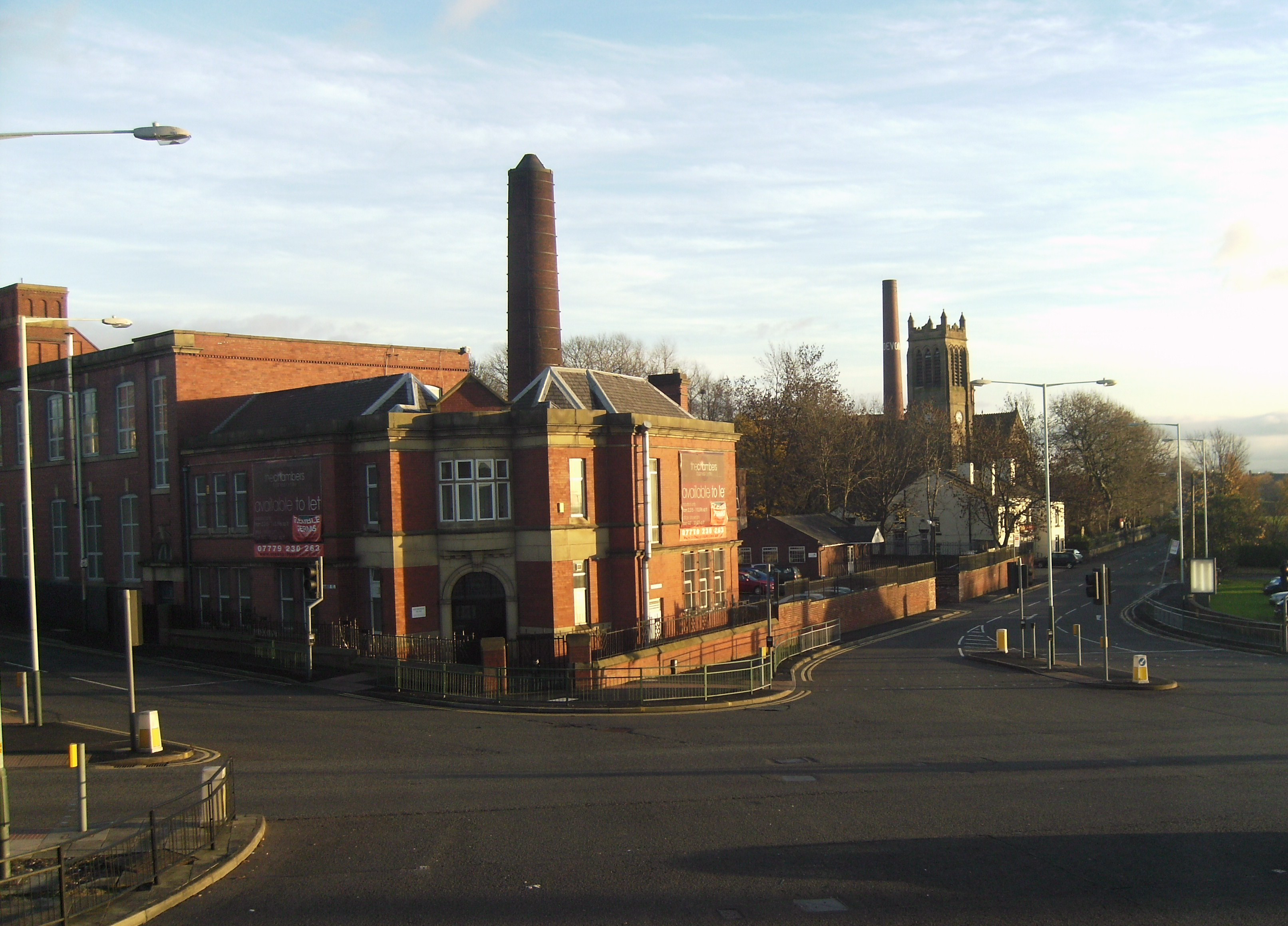
Imagen del área de Hollinwood, mostrando principalmente la iglesia y la antigua fábrica.

Hollinwood es un área de la ciudad de Oldham, en Gran Mánchester (Inglaterra). Se sitúa principalmente en la carretera A-62 de Inglaterra.

Históricamente una parte de Lancashire, Hollinwood antes era un pueblo en el municipio de Chadderton, pero la resolución jurisdiccional en 1713 estipulaba que Hollinwood debe estar dentro de Oldham, con la excepción de 20 acres (8,1 hectáreas), retenido por Chadderton.


Wikimedia foundation. 2010.

Игры ⚽ Нужен реферат?

Mira otros diccionarios:

  • Hollinwood — infobox UK place country = England latitude= 53.518389 longitude= 2.144048 official name= Hollinwood population= 9,909 (2001 Census) population density= 10,145 mile² (3,917 km²) metropolitan borough= Oldham metropolitan county= Greater Manchester …   Wikipedia

  • Hollinwood, Shropshire — Hollinwood is a small village in the English village of Shropshire.Hollinwood lies to the south of the town of Whitchurch and is about one mile from the border with Wales. External links *oscoor gbx|SJ521362 …   Wikipedia

  • Hollinwood Branch Canal — The Hollinwood Branch Canal was a canal near Hollinwood, in Oldham, England. It left the main line of the Ashton Canal at Fairfield Junction immediately above lock 18. It was just over convert|4.5|mi|km long (7.48 km) and went through Droylsden… …   Wikipedia

  • Hollinwood railway station — Infobox UK station name = Hollinwood manager = Northern Rail locale = Hollinwood borough = Oldham lowusage0405 = 45,709 lowusage0506 = 45,763 lowusage0607 = 48,789 platforms = 2 pte = Greater Manchester zone = start = code = HODHollinwood railway …   Wikipedia

  • Oldham — For other uses, see Oldham (disambiguation). For the larger local government district, see Metropolitan Borough of Oldham. Coordinates: 53°32′40″N 2°07′01″W /  …   Wikipedia

  • Manchester Piccadilly bus station — Piccadilly Gardens bus tram station …   Wikipedia

  • Daisy Nook — is a country park in Failsworth, Greater Manchester, England. The park runs through the Medlock Valley in an area once called Waterhouses. Waterhouses was one of three houses in the Failsworth area, the other two being Millhouses (now Clayton… …   Wikipedia

  • Stotts Tours (Oldham) — Infobox Bus transit name = Stotts Tours logo size = image size = image caption = company slogan = founded = headquarters = 144 Lees Road, Oldham, Greater Manchester locale = North West service area = Greater Manchester service type = School Bus,… …   Wikipedia

  • Oldham bus station — Oldham Oldham West Street bus station in 2008 …   Wikipedia

  • Chadderton — Coordinates: 53°32′46″N 2°08′33″W / 53.5462°N 2.1426°W / 53.5462; 2.1426 …   Wikipedia

Compartir el artículo y extractos

Link directo
Do a right-click on the link above
and select “Copy Link”