Hornellsville

Hornellsville
Hornellsville
Pueblo de los Estados Unidos
Hornellsville
Hornellsville
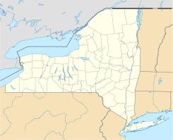
Ubicación en el condado de Steuben y en el estado de Nueva York
Map of USA NY.svg
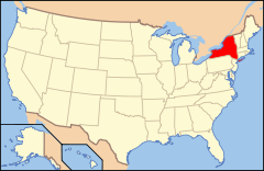
Ubicación de Nueva York en EE. UU.
42°20′46″N 77°40′26″O / 42.34611, -77.67389Coordenadas: 42°20′46″N 77°40′26″O / 42.34611, -77.67389
Entidad Pueblo
 • País Bandera de los Estados Unidos Estados Unidos
 • Estado Flag of New York.svg Nueva York
 • Condado Steuben
Superficie  
 • Total 113 km²
 • Tierra 112,6 km²
 • Agua (0,41%) 0,5 km²
Altitud  
 • Media 365 msnm
Población (2000)  
 • Total 4.042 hab.
 • Densidad 36 hab/km²
Huso horario Este: UTC-5
 • en verano UTC-4
Código de área 607
Sitio web oficial

Hornellsville es un pueblo ubicado en el condado de Steuben en el estado estadounidense de Nueva York. En el año 2000 tenía una población de 4,042 habitantes y una densidad poblacional de 36 personas por km².

Contenido

Geografía

Hornellsville se encuentra ubicado en las coordenadas 42°20′46″N 77°40′26″O / 42.34611, -77.67389.[1]

Demografía

Según la Oficina del Censo en 2000 los ingresos medios por hogar en la localidad eran de $36,932, y los ingresos medios por familia eran $48,688. Los hombres tenían unos ingresos medios de $33,426 frente a los $22,193 para las mujeres. La renta per cápita para la localidad era de $20,803. Alrededor del 8.4% de la población estaban por debajo del umbral de pobreza.[2]

Referencias

  1. «U.S. Gazetteer: Censo de 2010» (en inglés). Oficina del Censo de los Estados Unidos (16 de febrero de 2011). Consultado el 11 de julio de 2011.
  2. «American FactFinder» (en inglés). Oficina del Censo de los Estados Unidos. Consultado el 11 de julio de 2011.

Enlaces externos


Wikimedia foundation. 2010.

Игры ⚽ Нужна курсовая?

Mira otros diccionarios:

  • Hornellsville — (spr. hórnellswill), Stadt im Staat New York, Grafschaft Steuben, am Canisteo, Bahnknotenpunkt, mit Eisenbahnwerkstätten, Industrie in Holz, Eisenguß und Leder, Getreidehandel und (1900) 11,918 Einw …   Meyers Großes Konversations-Lexikon

  • Hornellsville — (spr. will), Stadt im nordamerik. Staate Neuyork, (1900) 11.918 E …   Kleines Konversations-Lexikon

  • Hornellsville, New York — Infobox Settlement official name = Hornellsville, New York settlement type = Town nickname = motto = imagesize = image caption = image |pushpin pushpin label position = pushpin map caption =Location within the state of New York pushpin mapsize =… …   Wikipedia

  • List of New York railroads — Current and former railroads in New York The following railroads operate in the U.S. state of New York. Contents 1 Common freight carriers …   Wikipedia

  • List of county routes in Steuben County, New York — County routes in Steuben County, New York, are maintained by the Steuben County highway department and signed with the Manual on Uniform Traffic Control Devices standard yellow on blue pentagon shield. No county routes enter the cities of Corning …   Wikipedia

  • Elmira and Lake Ontario Railroad — The Elmira and Lake Ontario Railroad was a subsidiary of the Northern Central Railway and later the Pennsylvania Railroad, formed to give the Northern Central an outlet for coal traffic on Lake Ontario. Contents 1 Predecessors 1.1… …   Wikipedia

  • Hornell, New York — Infobox Settlement official name = Hornell settlement type = City nickname = Maple City motto = imagesize = image caption = image |pushpin pushpin label position = pushpin map caption =Location within the state of New York pushpin mapsize =… …   Wikipedia

  • Erie Railroad — Reporting mark ERIE Locale Jersey City, NJ to Chicago, IL Dates of operation 1832–1960 Successor …   Wikipedia

  • Interstate 86 (east) — This article is about the current alignment of I 86 in Pennsylvania and New York. For the former alignment of I 86 east of East Hartford, Connecticut, see Interstate 84 (east). Interstate 86 …   Wikipedia

  • Steuben County, New York — Farmland in rural Steuben County, New York …   Wikipedia

Compartir el artículo y extractos

Link directo
Do a right-click on the link above
and select “Copy Link”