- Hotham Inlet
-
Hotham Inlet (Hotham Inlet) Ubicación geográfica Océano Mar de Chukotka Golfo Kotzebue Sound Continente América del Norte Ubicación administrativa País (es)  Estados Unidos
División (es)  Alaska
Subdivisión (es) Borough de Northwest Arctic Cuerpo de agua Ríos drenados Selawik (225 km) y Kobuk (451 km) Dimensiones Longitud 80 km (sin el lago Selawik) Anchura máxima 8-32 km Accidentes geográficos Golfos y bahías Lago Selawik y lago Ekichuk Otros accidentes Península de Baldwin Otros datos Área protegida Parque nacional Valle de Kobuk Exploración Frederick William Beechey (1826) Coordenadas Coordenadas: Mapa de localización Geolocalización del Hotham Inlet en Alaska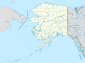
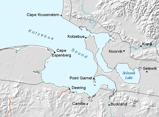
 Hotham InletLocalización del Hotham Inlet en el Kotzebue Sound
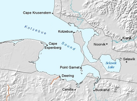
El Hotham Inlet es una pequeña y estrecha entrada marina (o entrante o brazo) del Kotzebue Sound localizada en la costa noroeste del estado de Alaska de los EE.UU.. Tiene unos 80 kilómetros de largo y una anchura de 8-32 km (el acceso desde el Kotzebue Sound tiene apenas 4 km de ancho). Tiene por límites: en el norte, el continente; en el este, el delta del río Kobuk, también en el continente; y, en el sur y oeste, la larga lengua de la península de Baldwin. En esta entrada desaguan los ríos Selawik (225 km) y Kobuk (451 km).
La parte central de la ribera oriental, la del delta del Kobuk, está protegida como parte del parque nacional Valle de Kobuk.
Contenido
Historia
Esta entrada fue descubierta en 1826 por el capitán de la la Royal Navy Frederick William Beechey y fue nombrada en reconocimiento a sir Henry Hotham, uno de los lores del Almirantazgo Británico.[1]
Véase también
Notas
- ↑ Beechey, Frederick William (1832). Narrative of a voyage to the Pacific and Beering's Strait: to co-operate with the Polar expeditions : performed in His Majesty's Ship Blossom, under the command of Captain F.W. Beechey, R.N. ... in the years 1825,26,27,28.. Philadelphia: Carey & Lea. http://books.google.com/books?id=7YcBAAAAYAAJ&pg=PA364&dq=Frederick+Beechey+1826&hl=en&ei=nqtYTMq_MYfSsAPLmKHuBQ&sa=X&oi=book_result&ct=result&resnum=3&ved=0CDQQ6AEwAg#v=onepage&q&f=false.
Referencias
- Este artículo fue creado a partir de la traducción del artículo Hotham Inlet de la Wikipedia en inglés, bajo licencia Creative Commons Atribución Compartir Igual 3.0 y GFDL.
-
- El artículo de la wikipedia en inglés cita como única referencia:
Categorías:- Golfos y bahías de Estados Unidos del océano Ártico
- Geografía de Alaska
- Mar de Chukotka

Wikimedia foundation. 2010.