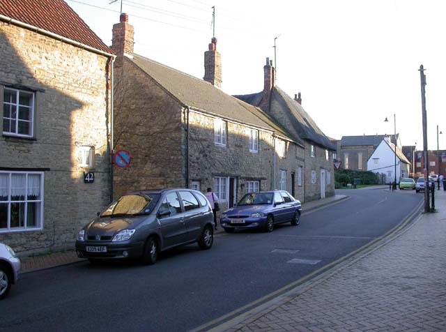
Irchester

Irchester
Irchester
Pueblo y parroquia civil del Reino Unido
High Street, Irchester - geograph.org.uk - 266898.jpg
Irchester
Irchester
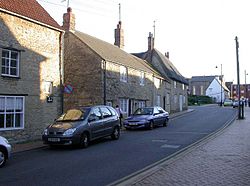
Ubicación en Northamptonshire.
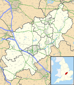
52°16′51.8154″N 0°38′42.072″O / 52.281059833, -0.64502Coordenadas: 52°16′51.8154″N 0°38′42.072″O / 52.281059833, -0.64502
Entidad Pueblo y parroquia civil
 • País Bandera del Reino Unido Reino Unido
 • Nación constitutiva Inglaterra
 • Región Midlands del Este
 • Condado Northamptonshire
 • Distrito Wellingborough
Población (2001)  
 • Total 4.807 hab.
Código postal NN29
Prefijo telefónico 01933

Irchester es un pueblo y una parroquia civil del distrito de Wellingborough, en el condado de Northamptonshire (Inglaterra).

Demografía

Según el censo de 2001,[1] Irchester tenía 4807 habitantes (2397 varones y 2410 mujeres). 872 (18,14%) de ellos eran menores de 16 años, 3543 (73,71%) tenían entre 16 y 74, y 392 (8,15%) eran mayores de 74. La media de edad era de 41 años. De los 3935 habitantes de 16 o más años, 873 (22,19%) estaban solteros, 2367 (60,15%) casados, y 695 (17,66%) divorciados o viudos. 2432 habitantes eran económicamente activos, 2352 de ellos (96,71%) empleados y otros 80 (3,29%) desempleados. Había 46 hogares sin ocupar, 2020 con residentes y 4 eran alojamientos vacacionales o segundas residencias.

Evolución demográfica de Irchester
1801 1811 1821 1831 1841 1851 1861 1871 1881 1891 1901 1911 1921 1931 1941 1951 1961
523 614 689 797 907 960 - - 1699 1824 2301 2224 2304 2503 - 2601 2832
(Fuente:Vision of Britain )

Referencias

  1. «Irchester» (en inglés). Office for National Statistics. Consultado el 29 de junio de 2011.

Enlaces externos


Wikimedia foundation. 2010.

Игры ⚽ Нужно сделать НИР?

Mira otros diccionarios:

  • Irchester — infobox UK place country = England official name= Irchester latitude= 52.2783 longitude= 0.6555 population= 5,000 shire district= Wellingborough shire county = Northamptonshire region= East Midlands constituency westminster= Wellingborough post… …   Wikipedia

  • Irchester — Original name in latin Irchester Name in other language State code GB Continent/City Europe/London longitude 52.28108 latitude 0.6451 altitude 77 Population 4610 Date 2010 05 24 …   Cities with a population over 1000 database

  • Irchester railway station — was built by the Midland Railway in 1857 on its extension from Leicester to Bedford and Hitchin.It was somewhat unique for the Midland in having its station building built on an overbridge. It closed for passenger traffic in 1960, and for goods… …   Wikipedia

  • Irchester United F.C. — Football club infobox clubname = Irchester United fullname = Irchester United Football Club nickname = The Romans founded = ground = The Irchester Sports Association Irchester capacity = chairman = Geoff Cotter 1st manager = Kenny Codrington 2nd… …   Wikipedia

  • Wellingborough — Coordinates: 52°17′38″N 0°41′47″W …   Wikipedia

  • Northamptonshire County Football Association — Northamptonshire County FA logo Purpose/focus Football association Location Moulton Park, Northampton Coordinates …   Wikipedia

  • River Nene — River The River Nene at Kislingbury Watermill, Northamptonshir …   Wikipedia

  • Stagecoach in Northants — Stagecoach Northants Founded Connect Kettering (March 2006) Connect Wellingborough (October 2006) Headquarters Northampton, Northamptonshire Service area All Nort …   Wikipedia

  • Northamptonshire — Coordinates: 52°17′N 0°50′W / 52.283°N 0.833°W / 52.283; 0.833 …   Wikipedia

  • Midland Main Line — This article is about the railway line. For the former train operating company, see Midland Mainline. Midland Main Line East Midlands Trains HST at Dore. Overview …   Wikipedia

Compartir el artículo y extractos

Link directo
Do a right-click on the link above
and select “Copy Link”