Kahlotus (Washington)

Kahlotus (Washington)
Kahlotus
Lugar designado por el censo de los Estados Unidos
Kahlotus as seen from Columbia Plateau Trail.jpgVista de Kahlotus
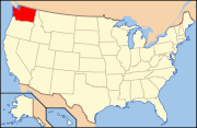
Ubicación en el condado de Franklin en el estado de Washington Ubicación de Washington en EE. UU.
Ubicación en el condado de Franklin en el estado de Washington
Map of USA WA.svg
Ubicación de Washington en EE. UU.
Entidad Lugar designado por el censo
 • País Bandera de los Estados Unidos Estados Unidos
 • Estado Flag of Washington.svg Washington
 • Condado Franklin
Superficie  
 • Total 1.1 km²
 • Tierra 1.1 km²
 • Agua 0.0 km²
Altitud  
 • Media 275 msnm
Población (2000)  
 • Total 214 hab.
 • Densidad 202,0 hab/km²
Huso horario Pacífico: UTC-8
 • en verano UTC-7
Código ZIP 99335
Código de área 509

Kahlotus es un lugar designado por el censo ubicado en el condado de Franklin en el estado estadounidense de Washington. En el año 2000 tenía una población de 214 habitantes y una densidad poblacional de 202,0 personas por km².[1]

Contenido

Geografía

Kahlotus se encuentra ubicado en las coordenadas 46°38′42″N 118°33′18″O / 46.645, -118.555Coordenadas: 46°38′42″N 118°33′18″O / 46.645, -118.555.[2]

Demografía

Según la Oficina del Censo en 2000 los ingresos medios por hogar en la localidad eran de $38.750, y los ingresos medios por familia eran $38.958. Los hombres tenían unos ingresos medios de $31.786 frente a los $25.179 para las mujeres. La renta per cápita para la localidad era de $16.617. Alrededor del 19,3% de la población estaban por debajo del umbral de pobreza.[3]

Referencias

  1. «Encuentra un condado» (en inglés). Asociación Nacional de Condados (11 de julio de 2011). Consultado el 11 de julio de 2011.
  2. «American FactFinder» (en inglés). Oficina del Censo de los Estados Unidos. Consultado el 11 de julio de 2011.
  3. «U.S. Gazetteer: Censo de 2010» (en inglés). Oficina del Censo de los Estados Unidos (16 de febrero de 2011). Consultado el 11 de julio de 2011.

Enlaces externos


Wikimedia foundation. 2010.

Игры ⚽ Нужно решить контрольную?

Mira otros diccionarios:

  • Kahlotus, Washington — Infobox Settlement official name = Kahlotus, Washington settlement type = City nickname = motto = imagesize = image caption = Kahlotus as seen from the Columbia Plateau Trail. image image mapsize = 250px map caption = Location of Kahlotus,… …   Wikipedia

  • Washington locations by per capita income — Washington is the twelfth richest state in the United States of America, with a per capita income of $22,973 (2000) and a personal per capita income of $33,332 (2003).Washington counties ranked by per capita incomeThere are thirty nine counties… …   Wikipedia

  • Kahlotus — Kahlotus, WA U.S. city in Washington Population (2000): 214 Housing Units (2000): 113 Land area (2000): 0.409019 sq. miles (1.059355 sq. km) Water area (2000): 0.000000 sq. miles (0.000000 sq. km) Total area (2000): 0.409019 sq. miles (1.059355… …   StarDict's U.S. Gazetteer Places

  • Kahlotus, WA — U.S. city in Washington Population (2000): 214 Housing Units (2000): 113 Land area (2000): 0.409019 sq. miles (1.059355 sq. km) Water area (2000): 0.000000 sq. miles (0.000000 sq. km) Total area (2000): 0.409019 sq. miles (1.059355 sq. km) FIPS… …   StarDict's U.S. Gazetteer Places

  • Washington State Route 260 — Infobox road state=WA type=WA route=260 direction a=West direction b=East terminus a= terminus b= junction= in Kahlotus previous type=SR previous route=243 next type=SR next route=261State Route 260 is a state route in the U.S. state of… …   Wikipedia

  • Washington Natural Areas Program — The Washington Natural Areas Program, part of the Washington Department of Natural Resources, manages dozens of natural areas owned by the US state of Washington. These areas have received funding through the state s general fund since the… …   Wikipedia

  • Washington State Route 21 — Infobox WA State Route|type=State|route=21|sec=085|formed=1964 length mi=191.28 length ref= length round=2 dir1=South|dir2=North from= junction= to= State Route 21, also known as SR 21, is a state highway in the U.S. state of Washington. It… …   Wikipedia

  • U.S. Route 395 in Washington — This article is about the section of U.S. Route 395 in Washington. For the entire length of the highway, see U.S. Route 395. U.S. Route 395 …   Wikipedia

  • U.S. Route 12 in Washington — This article is about the section of U.S. Route 12 in Washington. For the entire length of the highway, see U.S. Route 12. U.S. Route 12 US 12 hi …   Wikipedia

  • Tri-Cities, Washington — Infobox Settlement mapsize = 250px map caption = Location of the Kennewick Richland Pasco Metropolitan Statistical Area official name = Tri Cities nickname = TC, Wine Country, Atomic Town website = [http://www.visittri cites.com] subdivision type …   Wikipedia

Compartir el artículo y extractos

Link directo
Do a right-click on the link above
and select “Copy Link”