Khagrabari

Khagrabari
Khagrabari
Localidad de la India
Khagrabari  খাগড়াবাড়ি
Khagrabari
খাগড়াবাড়ি
Ubicación de Khagrabari en Bengala Occidental.
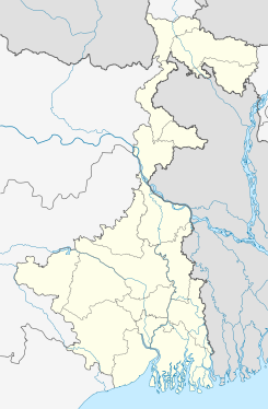
26°21′11″N 89°26′58″E / 26.35306, 89.44944Coordenadas: 26°21′11″N 89°26′58″E / 26.35306, 89.44944
Entidad Localidad
 • País Bandera de India India
 • Estado Bengala Occidental
 • Distrito Koch Bihar
Altitud  
 • Media 47 msnm
Población (Est.2010[1] )  
 • Total 22.249 hab.
Huso horario IST UTC +5:30
PIN[2] 736118
Código de área 3582

Khagrabari (en bengalí: খাগড়াবাড়ি ) es una ciudad de la India, en el distrito de Koch Bihar, estado de Bengala Occidental.

Contenido

Geografía

Se encuentra a una altitud de 47 msnm a 734 km de la capital estatal, Calcuta, en la zona horaria UTC +5:30.

Demografía

Según estimación 2010 contaba con una población de 22 249 habitantes.[1]

Referencias

Enlaces externos


Wikimedia foundation. 2010.

Игры ⚽ Поможем написать реферат

Mira otros diccionarios:

  • Khagrabari — Infobox Indian Jurisdiction native name = Khagrabari | type = city | latd = | longd = state name = West Bengal district = Koch Bihar leader title = leader name = altitude = population as of = 2001 population total = 19,762| population density =… …   Wikipedia

  • Kharimala Khagrabari — Infobox Indian Jurisdiction native name = Kharimala Khagrabari | type = city | latd = | longd = state name = West Bengal district = Koch Bihar leader title = leader name = altitude = population as of = 2001 population total = 7214| population… …   Wikipedia

  • Cooch Behar district — This article is about the district. For its eponymous headquarters, see Cooch Behar. Cooch Behar district কোচবিহার জেলা Location of Cooch Behar district in West …   Wikipedia

  • Cooch Behar Sadar subdivision —   subdistrict   …   Wikipedia

  • Cooch Behar II (community development block) — Cooch Behar II   community development block   …   Wikipedia

  • List of India-related articles — Articles (arranged alphabetically) related to India or Indian culture include: NOTOC List of India related topics People are listed by their first names. 1231 SGM 3 STR 2002 Gujarat violence 2005 in India ( previous years ) 2004 Indian Ocean… …   Wikipedia

  • Cities and towns in West Bengal — Image of Harrison Street Strand Road and Burra Bazaar in Kolkata (Calcutta) in 1945, shortly before the urban expansion of West Bengal West Bengal is the state with highest population density in India.[ …   Wikipedia

  • List of enclaves and exclaves — In political geography, an enclave is a piece of land which is totally surrounded by a foreign territory, and an exclave is one which is politically attached to a larger piece but not actually contiguous with it. Many entities are both enclaves… …   Wikipedia

  • Dinhata —   town   …   Wikipedia

  • Mathabhanga —   city   …   Wikipedia

Compartir el artículo y extractos

Link directo
Do a right-click on the link above
and select “Copy Link”