Khammam

Khammam
Khammam
Localidad de la India
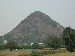
Pakhal Hills Near Khammam 2.jpg
Khammam  खम्मम
Khammam
खम्मम
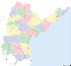
Ubicación de Khammam en Andhra Pradesh.
Ubicación de Andhra Pradesh en India.
17°15′02″N 80°08′49″E / 17.25056, 80.14694Coordenadas: 17°15′02″N 80°08′49″E / 17.25056, 80.14694
Entidad Localidad
 • País Bandera de India India
 • Estado Andhra Pradesh
 • Distrito Khammam
Altitud  
 • Media 123 msnm
Población (Est.2010[1] )  
 • Total 189.338 hab.
Huso horario IST UTC +5:30
PIN[2] 507001/2/3

Khammam (en hindi: खम्मम ) es una localidad de la India, centro administrativo del distrito de Khammam, estado de Andhra Pradesh.

Contenido

Geografía

Se encuentra a una altitud de 123 msnm a 192 km de la capital estatal, Hyderabad, en la zona horaria UTC +5:30.

Demografía

Según estimación 2010 contaba con una población de 189 338 habitantes.[1]

Referencias

Enlaces externos


Wikimedia foundation. 2010.

Игры ⚽ Поможем написать курсовую

Mira otros diccionarios:

  • Khammam — Infobox Indian Jurisdiction native name = Khammam | type = city | latd = 17.25 | longd = 80.15 locator position = right | state name = Andhra Pradesh district = Khammam leader title = leader name = altitude = 107 population as of = 2006… …   Wikipedia

  • Khammam — Original name in latin Khammam Name in other language Khammam, Khammamett, Khammamette, Kkhammam, ka mu ma mu, kam mam, kham mam, kham mama, khamam, Кхаммам State code IN Continent/City Asia/Kolkata longitude 17.24767 latitude 80.14368 altitude… …   Cities with a population over 1000 database

  • Khammam — Admin ASC 2 Code Orig. name Khammam Country and Admin Code IN.02.1267077 IN …   World countries Adminstrative division ASC I-II

  • Khammam (Lok Sabha constituency) — Khammam is a Lok Sabha parliamentary constituency of Andhra Pradesh.Members of Parliament Lok SabhaDurationName of M.P.Party AffiliationSecond1957 62T. B. Vittal RaoCommunist Party of IndiaThird1962 67LakshmikantammaIndian National… …   Wikipedia

  • Khammam district — Infobox Indian Jurisdiction type =district native name=Khammam hq =Khammam state name =Andhra Pradesh area = population total= 2565412 latd=17.25 |longd=80.15 website = http://khammam.nic.in/Khammam District (Telugu: ఖమ్మం జిల్లా, Hindi: खम्मम… …   Wikipedia

  • Khammam Fort — Construction of the Khammam Fort (India) was initiated around 950 when the Telugu area (now Andhra Pradesh) was ruled by the Kakatiya dynasty (10th 13th century). The Reddi Kings Velma and Laksham (Reddi dynasty 1328 1428) were actively involved… …   Wikipedia

  • Khammam — ▪ India       city, north central Andhra Pradesh state, southern India. It lies along the Central Railway, south southeast of Warangal. The city is a trade and commercial centre. Rice, jowar (grain sorghum), corn (maize), and pulses are grown in… …   Universalium

  • Bistum Khammam — Basisdaten Staat Indien Metropolitanbistum Erzbistum Hyderabad …   Deutsch Wikipedia

  • Narayanapuram, Khammam — Narayanapuram   village   Coordinates Country India State Andhra Pradesh …   Wikipedia

  • Kallur, Khammam district — Infobox Indian Jurisdiction native name = Kallur | type = city | latd = 17.2 | longd = 80.55 locator position = right | state name = Andhra Pradesh district = Khammam leader title = leader name = altitude = 104 population as of = 2001 population… …   Wikipedia

Compartir el artículo y extractos

Link directo
Do a right-click on the link above
and select “Copy Link”