Koderma

Koderma
Koderma
Localidad de la India
Koderma  कोडरमा
Koderma
कोडरमा
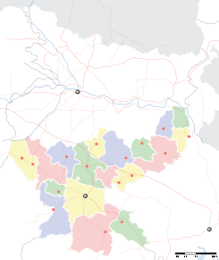
Ubicación de Koderma en Jharkhand.
Ubicación de Jharkhand en India.
24°28′02″N 85°35′34″E / 24.46722, 85.59278Coordenadas: 24°28′02″N 85°35′34″E / 24.46722, 85.59278
Entidad Localidad
 • País Bandera de India India
 • Estado Jharkhand
 • Distrito Koderma
Altitud  
 • Media 388 msnm
Población (Est.2010[1] )  
 • Total 22.087 hab.
Huso horario IST UTC +5:30
PIN[2] 825410

Koderma (en hindi: कोडरमा ) es una localidad de la India, centro administrativo del distrito de Koderma en el estado de Jharkhand.

Contenido

Geografía

Se encuentra a una altitud de 388 msnm a 169 km de la capital estatal, Ranchi, en la zona horaria UTC +5:30.

Demografía

Según estimación 2010 contaba con una población de 22 087 habitantes.[1]

Referencias

Enlaces externos


Wikimedia foundation. 2010.

Игры ⚽ Нужно решить контрольную?

Mira otros diccionarios:

  • Koderma district — is one of the twenty two districts of Jharkhand state, India, and Koderma is the administrative headquarters of this district.Koderma district was created on 10 April, 1994, after being carved out of the original Hazaribagh District. Koderma is… …   Wikipedia

  • Jhumri Tilaiya — Infobox Indian Jurisdiction type = town native name = Jhumri Tilaiya other name = Jhumri Telaiya/Jhumri Talaiya nickname = state name = Jharkhand skyline = skyline caption = latd = 24.43 longd= 85.52 locator position = left area total = area… …   Wikipedia

  • Chota Nagpur Plateau — For disambiguation, see Chota Nagpur (disambiguation). The Chota Nagpur Plateau (Hindi: छोटा नागपुर पठार) is a plateau in eastern India, which covers much of Jharkhand state as well as adjacent parts of Orissa, West Bengal, Bihar and Chhattisgarh …   Wikipedia

  • Mica Kings — refer to a business house, which took shape in the early twentieth century, in Koderma, Jharkhand state, India. This business house, at one point in time, controlled the largest share of mica mining and export activity in the world. Contents 1… …   Wikipedia

  • Kodarma — Infobox Indian Jurisdiction native name = Kodarma | type = city | latd = 24.47 | longd = 85.6 locator position = right | state name = Jharkhand district = Koderma leader title = leader name = altitude = 375 population as of = 2001 population… …   Wikipedia

  • Hazaribagh — Infobox Indian Jurisdiction native name = Hazaribag | type = city | latd = 23.98 | longd = 85.35 locator position = right | state name = Jharkhand district = Hazaribag leader title = leader name = altitude = 604 population as of = 2001 population …   Wikipedia

  • North Karanpura Coalfield — Location …   Wikipedia

  • Satyendra Dubey — Infobox Person name = Satyendra Dubey Occupation = NHAI Astt. Director, IES other names = image size = 150px caption = Birth date = birth date|1973 Death date = death date|2003|11|27Satyendra Kumar Dubey (1973 2003) was project director at the… …   Wikipedia

  • Dhanbad district — This article is about the district. For its eponymous headquarters, see Dhanbad. Dhanbad district धनबाद जिला Location of Dhanbad district in Jharkhand …   Wikipedia

  • Chatra district — This article is about the district. For its eponymous headquarters, see Chatra. Chatra district चतरा जिला Location of Chatra district in Jharkhand …   Wikipedia

Compartir el artículo y extractos

Link directo
Do a right-click on the link above
and select “Copy Link”