Kolaghat

Kolaghat
Kolaghat
Localidad de la India
Kolaghat  কোলাঘাট
Kolaghat
কোলাঘাট
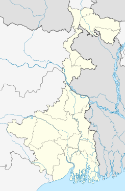
Ubicación de Kolaghat en Bengala Occidental.
22°25′53″N 87°51′30″E / 22.43139, 87.85833Coordenadas: 22°25′53″N 87°51′30″E / 22.43139, 87.85833
Entidad Localidad
 • País Bandera de India India
 • Estado Bengala Occidental
 • Distrito Midnapore oriental
Altitud  
 • Media 8 msnm
Población (Est.2010[1] )  
 • Total 25.385 hab.
Huso horario IST UTC +5:30
PIN[2] 721134
Código de área 3228

Kolaghat (en bengalí: কোলাঘাট ) es una ciudad de la India, en el distrito de Midnapore oriental, estado de Bengala Occidental.

Contenido

Geografía

Se encuentra a una altitud de 8 msnm a 65 km de la capital estatal, Calcuta, en la zona horaria UTC +5:30.

Demografía

Según estimación 2010 contaba con una población de 25 385 habitantes.[1]

Referencias

Enlaces externos


Wikimedia foundation. 2010.

Игры ⚽ Нужен реферат?

Mira otros diccionarios:

  • Kolaghat — Infobox Indian Jurisdiction native name = Kolaghat | type = city | latd = | longd = state name = West Bengal district = Purba Medinipur leader title = leader name = altitude = population as of = 2001 population total = 23,707| population density …   Wikipedia

  • College of Engineering and Management, Kolaghat — Established 1998 Type Privately funded Location Kolaghat …   Wikipedia

  • Mecheda —   town   …   Wikipedia

  • West Bengal Power Development Corporation Limited — (WBPDCL) is a company owned by the Government of West Bengal with the goal to carry on interalia the business of electric power generation and supply in the state of West Bengal, India. The main thermal power plants under WBPDCL are in Kolaghat,… …   Wikipedia

  • National Highway 41 (India) — 41 …   Wikipedia

  • Purba Medinipur district — পূ্র্ব মেদিনীপুর জেলা Location of Purba Medinipur district in West Bengal State …   Wikipedia

  • Kharagpur — Infobox Indian Jurisdiction native name=Kharagpur/Khadgapuramu latd = 22.02|longd=87.11 state name=West Bengal district=Midnapore West leader title=Mayor leader name= Sri Rabi Shankar Pandey altitude= population as of = 2001 | population total =… …   Wikipedia

  • Tamluk — Infobox Indian Jurisdiction native name = Tamluk | type = city | latd = 22.3 | longd = 87.92 locator position = right | state name = West Bengal district = Purba Medinipur leader title = leader name = altitude = 7 population as of = 2001… …   Wikipedia

  • National Highway 6 (India) — 6 …   Wikipedia

  • Hilsa — Taxobox | name = Hilsa image caption = Hilsa regnum = Animalia phylum = Chordata classis = Actinopterygii ordo = Clupeiformes familia = Clupeidae genus = Tenualosa species = T. ilisha binomial = Tenualosa ilisha binomial authority = (Hamilton,… …   Wikipedia

Compartir el artículo y extractos

Link directo
Do a right-click on the link above
and select “Copy Link”