Kotharia

Kotharia
Kotharia
Localidad de la India
Kotharia
Kotharia
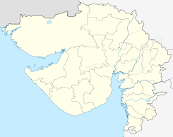
Ubicación de Kotharia en Guyarat.
22°14′05″N 70°49′11″E / 22.23472, 70.81972Coordenadas: 22°14′05″N 70°49′11″E / 22.23472, 70.81972
Entidad Localidad
 • País Bandera de India India
 • Estado Guyarat
 • Distrito Rajkot
Altitud  
 • Media 150 msnm
Población (Est.2011[1] )  
 • Total 24.102 hab.
Huso horario IST UTC +5:30
PIN[2] 363621

Kotharia es una ciudad de la India en el distrito de Rajkot, estado de Guyarat.

Contenido

Geografía

Se encuentra a una altitud de 150 msnm a 254 km de la capital estatal, Gandhinagar, en la zona horaria UTC +5:30.

Demografía

Según estimación 2011 contaba con una población de 24 102 habitantes.[1]

Referencias

Enlaces externos


Wikimedia foundation. 2010.

Игры ⚽ Нужно решить контрольную?

Mira otros diccionarios:

  • Kotharia — The boundaries of the Taluka were conterminous with those of the States of Morvi, Rajkot and Gondal States. The area of the Taluka was 27 square miles with 6 villages. The Taluka possessed six villages Kotharia, Vavdi, Vagudad , Khorana, Nagalpur …   Wikipedia

  • Rajsamand Lake — Infobox lake lake name = Rajsamand Lake image lake = caption lake = image bathymetry = caption bathymetry = location = Rajasthan coords = type = reservoir inflow = outflow = catchment = 508 km² basin countries = India length = width = area =… …   Wikipedia

  • Rajsamand — Infobox Indian Jurisdiction native name = Rajsamand | type = city | latd = 25.07 | longd = 73.88 locator position = right | state name = Rajasthan district = Rajsamand leader title = leader name = altitude = 547 population as of = 2001 population …   Wikipedia

  • Rajkot — Infobox Indian Jurisdiction type = City type 2 = district, subdistrict native name = Rājkot iucn category = state name = Gujarat skyline = skyline caption = latd = 22.3000 longd = 70.7833 locator position = right base map label = inset map marker …   Wikipedia

  • Baansi — Bansi is one of the sixteen thikanas of the house of Mewar. Ruled by the Shaktawat clan.बान्सी ठीकाना गांव: 80 REVENUE: 24,000Rs ACCESSION: 1956राज्य: Udaipur (Basti Distt.) DYNASTY: Sisodia (Shaktawat clan) RELIGION: HinduPOPULATION: 5,736… …   Wikipedia

  • History of Nepal — Kirat era Licchavi era Malla era Shah era (Rana era) 1990 democracy movement Nepalese Civil War 2006 democracy movement …   Wikipedia

  • List of Indian Princely States — Hundreds of princely states in British India existed prior to the independence of India and Pakistan (including the present Bangladesh) in 1947, ruled by semi independent potentates. Only four of the largest of these states were still directed by …   Wikipedia

  • History of Rajkot — Rajkot is the fourth largest city of Gujarat state. It is situated on the banks of Aji River in the western part of India. Rajkot has been under different rulers since it was founded. Rajkot has a large history and had a significant part in the… …   Wikipedia

  • Mewar — Agencia de Mewar hasta 1906. Agencia de los Estats de Rajputana Occiden …   Wikipedia Español

  • Kathiawar Agency — Kathiawar (1909, Besitzungen Barodas in gelb) Die 60.488 km² große Kathiawar Agency war eine verwaltungsmäßige Gruppierung von indischen Fürstenstaaten zur Zeit der Kolonialherrschaft auf der gleichnamigen Halbinsel. Sie grenzte im Osten an die… …   Deutsch Wikipedia

Compartir el artículo y extractos

Link directo
Do a right-click on the link above
and select “Copy Link”