Lamphelpat

Lamphelpat
Lamphelpat
Localidad de la India
Lamphelpat
Lamphelpat
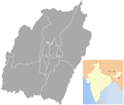
Ubicación de Lamphelpat en Manipur.
24°50′13″N 93°54′32″E / 24.83694, 93.90889Coordenadas: 24°50′13″N 93°54′32″E / 24.83694, 93.90889
Entidad Localidad
 • País Bandera de India India
 • Estado Manipur
 • Distrito Imphal occidental
Altitud  
 • Media 788 msnm
Población (Est.2010[1] )  
 • Total 16.776 hab.
Huso horario IST UTC +5:30
PIN[2] 795004
Código de área 3852

Lamphelpat es una localidad de la India, centro administrativo del distrito de Imphal occidental,en el estado de Manipur.

Contenido

Geografía

Se encuentra a una altitud de 788 msnm a 8 km de la capital estatal, Imfal, en la zona horaria UTC +5:30.

Demografía

Según estimación 2010 contaba con una población de 16 776 habitantes.[1]

Referencias

Enlaces externos


Wikimedia foundation. 2010.

Игры ⚽ Поможем сделать НИР

Mira otros diccionarios:

  • Lamphelpat — is the district headquarters of Imphal West in the state of Manipur, India …   Wikipedia

  • National Institutes of Technology — …   Wikipedia

  • Manipur — মণিপুর   State   Seal …   Wikipedia

  • Manipur University — Established June 5, 1980 Type Public Vice Chancellor Prof H Nandakumar [1] …   Wikipedia

  • Colleges and institutes in India — Colleges Institutes= Andhra Pradesh * Andhra Medical College * Bapatla Engineering College * Browns College of Pharmacy Khammam * Chaitanya Bharathi Institute of Technology (CBIT) * CMR College of Engineering Technology (CMRM) * Deccan College of …   Wikipedia

  • List of Kendriya Vidyalaya schools — The List of Kendriya Vidyalaya Schools (KV s) is a list of various individual Kendriya Vidyalayas. The KV schools are a chain of schools run by Kendriya Vidyalaya Sangathan, under the Government of India.tatewise ListAndaman Nicobar Islands*… …   Wikipedia

  • Department of Higher Education (India) — Department of Higher Education is the department under Ministry of Human Resource Development, that oversees higher education in India. The department is empowered to grant deemed university status to educational institutions on the advice of the …   Wikipedia

  • Manipur — – মনিপুর Status: Bundesstaat Hauptstadt: Imphal Fläche: 22.327 km² Einwohner …   Deutsch Wikipedia

  • List of districts of Manipur — Manipur, a state of India, has nine administrative districts. A district of an Indian state is an administrative geographical unit, headed by a district magistrate or a deputy commissioner, an officer belonging to the Indian Administrative… …   Wikipedia

Compartir el artículo y extractos

Link directo
Do a right-click on the link above
and select “Copy Link”