- Little Harrowden
-
Little Harrowden Pueblo y parroquia civil del Reino Unido Ubicación en Northamptonshire.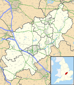
 Little Harrowden
Coordenadas: Entidad Pueblo y parroquia civil • País  Reino Unido
• Nación constitutiva Inglaterra • Región Midlands del Este • Condado Northamptonshire • Distrito Wellingborough Población (2001) • Total 881 hab. Código postal NN9 Prefijo telefónico 01933 Little Harrowden es un pueblo y una parroquia civil del distrito de Wellingborough, en el condado de Northamptonshire (Inglaterra).
Demografía
Según el censo de 2001,[1] Little Harrowden tenía 881 habitantes (408 varones y 473 mujeres). 136 de ellos (15,44%) eran menores de 16 años, 661 (75,03%) tenían entre 16 y 74, y 84 (9,53%) eran mayores de 74. La media de edad era de 43,99 años. De los 745 habitantes de 16 o más años, 170 (22,82%) estaban solteros, 439 (58,93%) casados, y 136 (18,25%) divorciados o viudos. 472 habitantes eran económicamente activos, 452 de ellos (95,76%) empleados y otros 20 (4,24%) desempleados. Había 12 hogares sin ocupar y 399 con residentes.
Evolución demográfica de Little Harrowden 1801 1811 1821 1831 1841 1851 1861 1871 1881 1891 1901 1911 1921 1931 1941 1951 1961 284 347 420 465 673 638 - - 828 770 604 682 689 698 - 662 758 (Fuente:Vision of Britain ) Referencias
- ↑ «Little Harrowden» (en inglés). Office for National Statistics. Consultado el 3 de julio de 2011.
Enlaces externos
 Wikimedia Commons alberga contenido multimedia sobre Little Harrowden. Commons
Categoría:- Localidades de Northamptonshire

Wikimedia foundation. 2010.