Marion Forks

Marion Forks
Marion Forks
Área no incorporada de los Estados Unidos
Marion Forks
Marion Forks
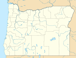
Ubicación en el condado de Linn en Oregón
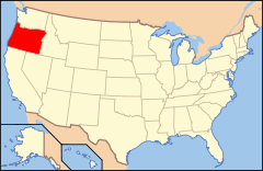
Ubicación de Oregón en EE. UU.
44°36′56″N 121°56′49″O / 44.61556, -121.94694Coordenadas: 44°36′56″N 121°56′49″O / 44.61556, -121.94694
Entidad Área no incorporada
 • País Bandera de los Estados Unidos Estados Unidos
 • Estado Bandera de Oregón Oregón
 • Condado Linn
Altitud  
 • Media 743 msnm
Huso horario Pacífico: UTC-8
 • en verano UTC-7

Marion Forks es un área no incorporada ubicada en el condado de Linn en el estado estadounidense de Oregón. Marion Forks se encuentra ubicada a 15 millas de Detroit.[1]

Geografía

Marion Forks se encuentra ubicada en las coordenadas 44°36′56″N 121°56′49″O / 44.61556, -121.94694Coordenadas: 44°36′56″N 121°56′49″O / 44.61556, -121.94694.[2]

Referencias

  1. «Encuentra un condado» (en inglés). Asociación Nacional de Condados (11 de julio de 2011). Consultado el 11 de julio de 2011.
  2. «American FactFinder» (en inglés). Oficina del Censo de los Estados Unidos. Consultado el 11 de julio de 2011.

Enlaces externos


Wikimedia foundation. 2010.

Игры ⚽ Нужно решить контрольную?

Mira otros diccionarios:

  • Marion Forks, Oregon — Marion Forks   Unincorporated community   Marion Forks Restaurant …   Wikipedia

  • Marion Forks Guard Station — U.S. National Register of Historic Places …   Wikipedia

  • Marion — ist ein Name, siehe Marion (Name) Marion bezeichnet ein eisenzeitliches Königreich auf Zypern, siehe Marion (Königreich) eine zu den Prinz Edward Inseln gehörige Insel zwei ehemalige Automobilhersteller in den USA, siehe Marion (Auto) einen Ort… …   Deutsch Wikipedia

  • Marion, Arkansas —   City   Welcome to Marion sign …   Wikipedia

  • National Register of Historic Places listings in Marion County, Oregon — Location of Marion County in Oregon The following list presents the full set of National Register of Historic Places listings in Marion County, Oregon, and offers brief descriptive information about each of them. The National Register of Historic …   Wikipedia

  • National Register of Historic Places listings in Linn County, Oregon — This is a list of properties and districts in Linn County, Oregon that are listed on the National Register of Historic Places. Map of all coordinates from Google Map of all coordinates from Bing …   Wikipedia

  • Mill City, Oregon —   City   Pedestrian bridge over the North Santiam River at Mill City …   Wikipedia

  • North Santiam River — Coordinates: 44°41′12″N 123°00′24″W / 44.68667°N 123.00667°W / 44.68667; 123.00667 …   Wikipedia

  • Scouting in Oregon — Oregon Trail Council redirects here. For the organization relating to the Oregon Trail, see Oregon Historic Trails Advisory Council. The history of Scouting in Oregon began in the 1910s and continues to the present day, serving thousands of youth …   Wikipedia

  • Oregon Route 22 — For the unsigned Highway 22, see Crater Lake Highway. Oregon Route 22 Route information …   Wikipedia

Compartir el artículo y extractos

Link directo
Do a right-click on the link above
and select “Copy Link”