Mist (Oregón)

Mist (Oregón)
Mist
Área no incorporada de los Estados Unidos
Mist
Mist
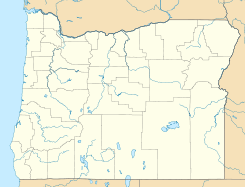
Ubicación en el condado de Columbia y en el estado de Oregón
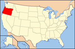
Map of USA OR.svg
Ubicación de Oregon en EE. UU.
45°59′47″N 123°15′19″O / 45.99639, -123.25528Coordenadas: 45°59′47″N 123°15′19″O / 45.99639, -123.25528
Entidad Área no incorporada
 • País Bandera de los Estados Unidos Estados Unidos
 • Estado Bandera de Oregón Oregón
 • Condado Columbia
Altitud  
 • Media 111 msnm
Huso horario Pacífico: UTC-8
 • en verano UTC-7
Código de área 503

Mist es un área no incorporada ubicada en el condado de Columbia en el estado estadounidense de Oregón. Mist se encuentra al noroeste de Mist.[1]

Geografía

Mist se encuentra ubicado en las coordenadas 45°59′47″N 123°15′19″O / 45.99639, -123.25528Coordenadas: 45°59′47″N 123°15′19″O / 45.99639, -123.25528.[2]

Referencias

  1. «U.S. Gazetteer: Censo de 2010» (en inglés). Oficina del Censo de los Estados Unidos (16 de febrero de 2011). Consultado el 11 de julio de 2011.
  2. «American FactFinder» (en inglés). Oficina del Censo de los Estados Unidos. Consultado el 11 de julio de 2011.

Enlaces externos


Wikimedia foundation. 2010.

Игры ⚽ Нужен реферат?

Mira otros diccionarios:

  • Mist, Oregon — Mist   Unincorporated community   …   Wikipedia

  • Mist (disambiguation) — Mist is a weather phenomenon similar to fog. Mist may also refer to: Comics Mist (comics), a supervillain of Starman comics Education Michigan State University, a public research university in East Lansing, Michigan, in the United States The… …   Wikipedia

  • Oregon Route 47 — For the unsigned Highway 47, see Sunset Highway (Oregon). Oregon Route 47 Route i …   Wikipedia

  • Oregon Route 202 — For the former unsigned Highway 202, see Tampico Lewisville Highway. Oregon Route 202 Route infor …   Wikipedia

  • Columbia County, Oregon — Location in the state of Oregon …   Wikipedia

  • U.S. Route 30 in Oregon — For the unsigned Highway 30, see Willamina Salem Highway. This article is about the section of U.S. Route 30 in Oregon. For the entire length of the highway, see U.S. Route 30. U.S. Route 30 …   Wikipedia

  • U.S. Route 26 in Oregon — OR 2 redirects here. OR 2 may also refer to Oregon s 2nd congressional district. This article is about the section of U.S. Route 26 in Oregon. For the entire length of the highway, see U.S. Route 26. U.S. Route 26 …   Wikipedia

  • List of cities and unincorporated communities in Oregon — Government Camp NOEDITSECTION This List of cities and unincorporated communities in the U.S. state of Oregon includes all incorporated cities and many unincorporated communities, arranged in alphabetical order. Unincorporated communities are… …   Wikipedia

  • National Register of Historic Places listings in Columbia County, Oregon — Location of Columbia County in Oregon The following list presents the full set of National Register of Historic Places listings in Columbia County, Oregon, and offers brief descriptive information about each of them. The National Register of… …   Wikipedia

  • Mayger, Oregon —   Unincorporated community   …   Wikipedia

Compartir el artículo y extractos

Link directo
Do a right-click on the link above
and select “Copy Link”