Mole Valley

Mole Valley
Mole Valley
Distrito del Reino Unido
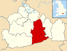
Mole Valley UK locator map.svg
Ubicación en el condado de Surrey.
Entidad Distrito
 • País Bandera del Reino Unido Reino Unido
 • Nación constitutiva Inglaterra
 • Región Sudeste de Inglaterra
 • Condado Surrey
Superficie  
 • Total 258.32 km²
Población (2001)  
 • Total 80 287 hab.
 • Densidad 310,8 hab/km²

Mole Valley es un distrito no metropolitano del condado de Surrey (Inglaterra). Tiene una superficie de 258,32 km². Según el censo de 2001, Mole Valley estaba habitado por 80 287 personas y su densidad de población era de 310,8 hab/km².[1]

Referencias

  1. «Find statistics for an area» (en inglés). Office for National Statistics. Consultado el 13 de agosto de 2011.

Wikimedia foundation. 2010.

Игры ⚽ Поможем написать реферат

Mira otros diccionarios:

  • Mole Valley — District Lage in Surrey Status District Region South East England Verw.grafschaft Surrey …   Deutsch Wikipedia

  • Mole Valley — For the Westminster Parliament constituency, see Mole Valley (UK Parliament constituency) and Epsom and Ewell (UK Parliament constituency) Mole Valley District   Non metropolitan district   …   Wikipedia

  • Mole Valley S.C.R. F.C. — Infobox Football club clubname = Mole Valley S.C.R. fullname = Mole Valley S.C.R. Football Club nickname = founded = 2008 ground = capacity = chairman = manager = league = Combined Counties League Division OneMole Valley S.C.R. F.C. are a… …   Wikipedia

  • Mole Valley Farmers — Type Agricultural cooperative Founded 1960 (1960) Headquarters Devon, South West England Key people D A Burke, Chairman, G M Cock, P Delbridg …   Wikipedia

  • Mole Valley SCR F.C. — Mole Valley SCR Full name Mole Valley Sutton Common Road Football Club Nickname(s) The Commoners Founded 1978 Ground …   Wikipedia

  • Mole Valley local elections — One third of Mole Valley Council in Surrey, England is elected each year, followed by one year when there is an election to Surrey County Council instead. Contents 1 Political control 2 Council elections 3 By election results …   Wikipedia

  • Mole Valley (UK Parliament constituency) — Coordinates: 51°15′58″N 0°19′41″W / 51.266°N 0.328°W / 51.266; 0.328 …   Wikipedia

  • Mole Valley Council election, 2000 — Elections to Mole Valley Council were held on 4 May 2000. The whole council was up for election with boundary changes since the last election in 1999. The council stayed under no overall control. Election result Mole Valley Local Election Result… …   Wikipedia

  • Mole Valley Council election, 2002 — Elections to Mole Valley Council were held on 2 May 2002. One third of the council was up for election and the council stayed under no overall control. After the election, the composition of the council was Conservative 18 Liberal Democrat 15… …   Wikipedia

  • Mole Valley Council election, 2004 — Elections to Mole Valley Council were held on 10 June 2004. One third of the council was up for election and the council stayed under no overall control. Overall turnout was 49.8%. After the election, the composition of the council was… …   Wikipedia

Compartir el artículo y extractos

Link directo
Do a right-click on the link above
and select “Copy Link”