Nagod

Nagod
Nagod
Localidad de la India
Nagod
Nagod
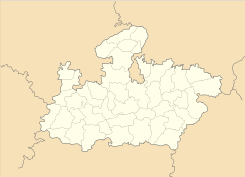
Ubicación de Nagod en Madhya Pradesh.
Ubicación de Madhya Pradesh en India.
24°34′09″N 80°35′08″E / 24.56917, 80.58556Coordenadas: 24°34′09″N 80°35′08″E / 24.56917, 80.58556
Entidad Localidad
 • País Bandera de India India
 • Estado Madhya Pradesh
 • Distrito Satna
Altitud  
 • Media 334 msnm
Población (Est.2010[1] )  
 • Total 24.720 hab.
Huso horario IST UTC +5:30
PIN[2] 485446

Nagod es una localidad de la India en el distrito de Satna, estado de Madhya Pradesh.

Contenido

Geografía

Se encuentra a una altitud de 334 msnm a 425 km de la capital estatal, Bhopal, en la zona horaria UTC +5:30.

Demografía

Según estimación 2010 contaba con una población de 24 720 habitantes.[1]

Referencias

Enlaces externos


Wikimedia foundation. 2010.

Игры ⚽ Поможем написать реферат

Mira otros diccionarios:

  • Nagod —   city   …   Wikipedia

  • Nagod — Nagod …   Deutsch Wikipedia

  • Nagod — Original name in latin Ngod Name in other language Nagod, Ngod State code IN Continent/City Asia/Kolkata longitude 24.5705 latitude 80.58655 altitude 334 Population 21732 Date 2012 09 06 …   Cities with a population over 1000 database

  • Nagod (Vidhan Sabha constituency) — Nagod Vidhan Sabha constituency (Hindi: नागौद विधान सभा निर्वाचन क्षेत्र) is one of the 230 Vidhan Sabha (Legislative Assembly) constituencies of Madhya Pradesh state in central India.[1] This constituency came into existence in 1951, as one of… …   Wikipedia

  • Nagod (Staat) — Flagge von Nagod Kartenausschnitt aus dem Imperial Gazetteer of India Nagod w …   Deutsch Wikipedia

  • List of Indian Princely States — Hundreds of princely states in British India existed prior to the independence of India and Pakistan (including the present Bangladesh) in 1947, ruled by semi independent potentates. Only four of the largest of these states were still directed by …   Wikipedia

  • Unchehra — is a block and one of six tehsils of Satna district (i.e. Majhganwa, Sohawal, Rampur Baghelan, Nagod, Unchehra, Amarpatan, Ramnagar, Maihar) situted around 24 degree 20 minute North Longitude, 80n degree 44 minute East Latitude in the viscinity… …   Wikipedia

  • Pratihara — The Pratiharas (Hindi प्रतिहार pratihāra), also known as Parihars , formed an Indian dynasty that ruled a large kingdom in northern India from the 6th to the 11th centuries. They are called Gurjara Pratiharas in one late inscription. The people… …   Wikipedia

  • Panna, India — Infobox Indian Jurisdiction native name = Panna | type = city | latd = 24.72 | longd = 80.2 locator position = right | state name = Madhya Pradesh district = Panna leader title = leader name = altitude = 433 population as of = 2001 population… …   Wikipedia

  • Alexander Cunningham — Sir Alexander Cunningham (23 January 1814 ndash;28 November 1893) was a British archaeologist and army engineer, known as the father of the Archaeological Survey of India. Both his brothers, Francis Cunningham and Joseph Cunningham became well… …   Wikipedia

Compartir el artículo y extractos

Link directo
Do a right-click on the link above
and select “Copy Link”