Nartiang

Nartiang
Nartiang
Localidad de la India
Nartiang
Nartiang
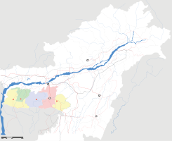
Ubicación de Nartiang en Megalaya.
25°34′44″N 92°13′11″E / 25.57889, 92.21972Coordenadas: 25°34′44″N 92°13′11″E / 25.57889, 92.21972
Entidad Localidad
 • País Bandera de India India
 • Estado Megalaya
 • Distrito Jaintia Hills
Altitud  
 • Media 1223 msnm
Población (Est.2010[1] )  
 • Total 2.946 hab.
Huso horario IST UTC +5:30
PIN[2] 793151

Nartiang es una localidad de la India, en el distrito de Jaintia Hills, estado de Megalaya.

Contenido

Geografía

Se encuentra a una altitud de 1223 msnm a 61 km de la capital estatal, Shillong, en la zona horaria UTC +5:30.

Demografía

Según estimación 2010 contaba con una población de 2 946 habitantes.[1]

Referencias

Enlaces externos


Wikimedia foundation. 2010.

Игры ⚽ Поможем сделать НИР

Mira otros diccionarios:

  • Nartiang Durga Temple — is a 500 year old Durga Temple located in the Jaintia Hills District of Meghalaya, a state in North Eastern India. Being one of the 51 Shakti Peeths of Hindu Mythology, this temple is one of the holiest sites for devotees of the Shakti cult of… …   Wikipedia

  • Hill States — The term hill states means states in a hilly area. In particular it is used for two northern border regions of colonial British India. Contents 1 Raj period Punjab 1.1 Simla Hills 1.2 Punjab Hills States …   Wikipedia

Compartir el artículo y extractos

Link directo
Do a right-click on the link above
and select “Copy Link”