- Nongstoin
-
Nongstoin Localidad de la India Ubicación de Nongstoin en Megalaya.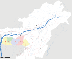
 Nongstoin
Coordenadas: Entidad Localidad • País  India
India• Estado Megalaya • Distrito West Khasi Hills Altitud • Media 1329 msnm Población (Est.2010[1] ) • Total 34.104 hab. Huso horario IST UTC +5:30 PIN[2] 793119 Código de área 3654 Nongstoin es una localidad de la India, centro administrativo del distrito de West Khasi Hills, en el estado de Megalaya.
Contenido
Geografía
Se encuentra a una altitud de 1329 msnm a 94 km de la capital estatal, Shillong, en la zona horaria UTC +5:30.
Demografía
Según estimación 2010 contaba con una población de 34 104 habitantes.[1]
Referencias
Enlaces externos
Categoría:- Localidades de Megalaya

Wikimedia foundation. 2010.