Northwest Harwinton

Northwest Harwinton
Northwest Harwinton
Lugar designado por el censo de los Estados Unidos
Northwest Harwinton
Northwest Harwinton
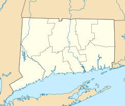
Ubicación en el condado de Litchfield en el estado de Connecticut
Map of USA CT.svg
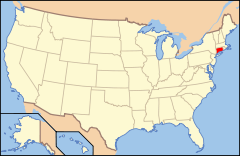
Ubicación de Connecticut en EE. UU.
41°46′43″N 73°04′53″O / 41.77861, -73.08139Coordenadas: 41°46′43″N 73°04′53″O / 41.77861, -73.08139
Entidad Lugar designado por el censo
 • País Bandera de los Estados Unidos Estados Unidos
 • Estado Bandera de Connecticut Connecticut
 • Condado Litchfield
Superficie  
 • Total 22,8 km²
 • Tierra 22,5 km²
 • Agua (1,14%) 0,4 km²
Población (2000)  
 • Total 3.242 hab.
 • Densidad 143.9 hab/km²
Huso horario Este: UTC-5
 • en verano UTC-4
Código de área 860

Northwest Harwinton es un lugar designado por el censo ubicado en el condado de Litchfield en el estado estadounidense de Connecticut. En el año 2000 tenía una población de 3,242 habitantes y una densidad poblacional de 143.9 personas por km².[1]

Contenido

Geografía

Northwest Harwinton se encuentra ubicado en las coordenadas 41°46′43″N 73°04′53″O / 41.77861, -73.08139Coordenadas: 41°46′43″N 73°04′53″O / 41.77861, -73.08139.[2]

Demografía

Según la Oficina del Censo en 2000 los ingresos medios por hogar en la localidad eran de $58,295 y los ingresos medios por familia eran $65,795. Los hombres tenían unos ingresos medios de $47,083 frente a los $40,161 para las mujeres. La renta per cápita para la localidad era de $26,508. Alrededor del 2.9% de la población estaba por debajo del umbral de pobreza.[3]

Referencias

  1. «Encuentra un condado» (en inglés). Asociación Nacional de Condados (11 de julio de 2011). Consultado el 11 de julio de 2011.
  2. «American FactFinder» (en inglés). Oficina del Censo de los Estados Unidos. Consultado el 11 de julio de 2011.
  3. «U.S. Gazetteer: Censo de 2010» (en inglés). Oficina del Censo de los Estados Unidos (16 de febrero de 2011). Consultado el 11 de julio de 2011.

Enlaces externos


Wikimedia foundation. 2010.

Игры ⚽ Нужно сделать НИР?

Mira otros diccionarios:

  • Northwest Harwinton — is a census designated place (CDP) in the town of Harwinton in Litchfield County, Connecticut, United States. The population was 3,242 at the 2000 census. The CDP is generally the area west of Harmony Hill Road and Plymouth Road, and north of… …   Wikipedia

  • Northwest Harwinton — Northwest Harwinton, CT U.S. Census Designated Place in Connecticut Population (2000): 3242 Housing Units (2000): 1296 Land area (2000): 8.704309 sq. miles (22.544055 sq. km) Water area (2000): 0.104202 sq. miles (0.269881 sq. km) Total area… …   StarDict's U.S. Gazetteer Places

  • Northwest Harwinton, CT — U.S. Census Designated Place in Connecticut Population (2000): 3242 Housing Units (2000): 1296 Land area (2000): 8.704309 sq. miles (22.544055 sq. km) Water area (2000): 0.104202 sq. miles (0.269881 sq. km) Total area (2000): 8.808511 sq. miles… …   StarDict's U.S. Gazetteer Places

  • Northwest Harwinton — 41°46′43″N 73°04′53″O / 41.77861, 73.08139 Northwest Harwinton est une ville située dans le comté d …   Wikipédia en Français

  • Northwest Harwinton — Original name in latin Northwest Harwinton Name in other language State code US Continent/City America/New York longitude 41.77685 latitude 73.07922 altitude 295 Population 3252 Date 2011 05 14 …   Cities with a population over 1000 database

  • Northwest Harwinton (Connecticut) — Northwest Harwinton Northwest Harwinton est une ville située dans le comté de Litchfield, dans l État du Connecticut (États Unis). Selon le recensement de 2000, Northwest Harwinton avait une population totale de 3 242 habitants. Géographie… …   Wikipédia en Français

  • Harwinton, Connecticut — Infobox Settlement official name = Harwinton, Connecticut settlement type = Town imagesize = image caption = mapsize = 250px map caption = Location in Connecticut mapsize1 = map caption1 = subdivision type = NECTA subdivision name = Hartford… …   Wikipedia

  • National Register of Historic Places listings in Litchfield County, Connecticut — Location of Litchfield County in Connecticut This is a list of the National Register of Historic Places listings in Litchfield County, Connecticut. This is intended to be a complete list of the properties and districts on the National Register of …   Wikipedia

  • Litchfield County, Connecticut — Infobox U.S. County county = Litchfield County state = Connecticut map size = 250 founded = 1751 seat = none; Connecticut counties do not have a county government area total sq mi =945 area land sq mi =920 area water sq mi =25 area percentage = 2 …   Wikipedia

  • Morris, Connecticut —   Town   Seal …   Wikipedia

Compartir el artículo y extractos

Link directo
Do a right-click on the link above
and select “Copy Link”