Olivenhain (California)

Olivenhain (California)
Olivenhain
Comunidad de los Estados Unidos
Olivenhain CA view of Pacific Ocean.jpg
Vista de Olivenhain
Olivenhain
Olivenhain

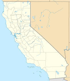
Mapa de Olivenhain
33°02′46″N 117°14′05″O / 33.04611, -117.23472Coordenadas: 33°02′46″N 117°14′05″O / 33.04611, -117.23472
Entidad Comunidad
 • País Bandera de los Estados Unidos Estados Unidos
 • Estado Flag of California.svg California
 • Condado San Diego
Fundación 21 de mayo de 1884
Superficie  
Huso horario Pacífico: UTC-8/-7
Código postal 92024
Sitio web oficial
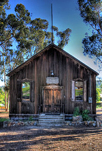
Salón de Reuniones

Olivenhain es una comunidad rural de cinco comunidades de Encinitas del condado de San Diego en el estado estadounidense de California. La localidad se encuentra ubicada al oeste de Rancho Santa Fe.[1] La comunidad empezó a poblarse a inicios de 1884 por un grupo de alemanes. Debido a su baja densidad, la comunidad tiene alrededor de 1500 viviendas.

Referencias

  1. «U.S. Gazetteer: Censo de 2010» (en inglés). Oficina del Censo de los Estados Unidos (16 de febrero de 2011). Consultado el 11 de julio de 2011.

Enlaces externos


Wikimedia foundation. 2010.

Игры ⚽ Поможем написать реферат

Mira otros diccionarios:

  • Olivenhain, California — Olivenhain   Unincorporated community   …   Wikipedia

  • Olivenhain Dam — and reservoir in 2011 as seen from a helicopter …   Wikipedia

  • California County Routes in zone S — There are 34 routes assigned to the S zone of the California Route Marker Program, which designates county routes in California. The S zone includes county highways lying in the counties of Imperial, Orange, Riverside, San Diego, and Santa… …   Wikipedia

  • National Register of Historic Places listings in San Diego County, California — Location of San Diego County in California This list includes properties and districts listed on the National Register of Historic Places in San Diego County, California. Click the Map of all coordinates link to the right to view a Google map of… …   Wikipedia

  • Encinitas, California — Encinitas   City   Aerial view shows: Moonlight Beach on the left, parallel with the shore is US Route 101, also parallel but further inland is …   Wikipedia

  • County Route S10 (California) — Infobox CA Co highway name = County Route S10 marker alternate name = Olivenhain Rd/Rancho Santa Fe Rd length = 9.74 miles direction = South/North starting terminus = major junctions = in San Marcos ending terminus = in San Marcos cities =… …   Wikipedia

  • San Diego County, California — County of San Diego   County   Seal …   Wikipedia

  • Carlsbad, California — Carlsbad   City   City of Carlsbad …   Wikipedia

  • Encinitas (California) — Encinitas, California Bandera …   Wikipedia Español

  • List of Registered Historic Places in San Diego County, California — List of Registered Historic Places in San Diego County, California::California NRHP date for listsCurrent RHPs in San Diego CountyThis document is intended to provide a comprehensive listing of the 129 entries in the National Register of Historic …   Wikipedia

Compartir el artículo y extractos

Link directo
Do a right-click on the link above
and select “Copy Link”