- South Coffeyville (Oklahoma)
-
South Coffeyville Pueblo de los Estados Unidos 
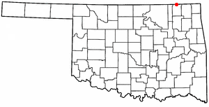
Ubicación en el condado de Nowata en Oklahoma
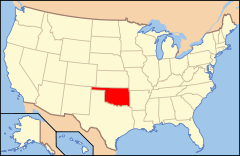
Ubicación de Oklahoma en EE. UU.Entidad Pueblo • País  Estados Unidos
• Estado  Oklahoma
• Condado Nowata Superficie • Total 1,6 km² • Tierra 1,6 km² • Agua (0%) 0 km² Altitud • Media 221 msnm Población (2010) • Total 785 hab. • Densidad 490,63 hab/km² Huso horario Centro: UTC-6 • en verano UTC-5 Código ZIP 74072 Código de área 539/918 South Coffeyville es un pueblo ubicado en el condado de Nowata en el estado estadounidense de Oklahoma. En el año 2010 tenía una población de 785 habitantes y una densidad poblacional de 490,63 personas por km².[1]
Contenido
Geografía
South Coffeyville se encuentra ubicado en las coordenadas (36.994064, -95.621042).[2]
Demografía
Según la Oficina del Censo en 2000 los ingresos medios por hogar en la localidad eran de $29,688 y los ingresos medios por familia eran $37,109. Los hombres tenían unos ingresos medios de $29,107 frente a los $20,179 para las mujeres. La renta per cápita para la localidad era de $16,560. Alrededor del 12.5% de la población estaban por debajo del umbral de pobreza.[3]
Referencias
- ↑ «Encuentra un condado» (en inglés). Asociación Nacional de Condados (11 de julio de 2011). Consultado el 11 de julio de 2011.
- ↑ «U.S. Gazetteer: Censo de 2010» (en inglés). Oficina del Censo de los Estados Unidos (16 de febrero de 2011). Consultado el 11 de julio de 2011.
- ↑ «American FactFinder» (en inglés). Oficina del Censo de los Estados Unidos. Consultado el 11 de julio de 2011.
Enlaces externos
 Portal:Oklahoma. Contenido relacionado con Oklahoma.
 Wikimedia Commons alberga contenido multimedia sobre South Coffeyville (Oklahoma). Commons
Categorías:- Pueblos de Oklahoma
- Localidades del condado de Nowata

Wikimedia foundation. 2010.