- Stokesby with Herringby
-
Stokesby with Herringby Parroquia civil del Reino Unido Ubicación en Norfolk.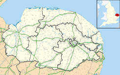
 Stokesby with Herringby
Coordenadas: Entidad Parroquia civil • País  Reino Unido
• Nación constitutiva Inglaterra • Región Este de Inglaterra • Condado Norfolk • Distrito Great Yarmouth Población (2001) • Total 293 hab. Código postal NR29 Prefijo telefónico 01493 Stokesby with Herringby es una parroquia civil del distrito de Great Yarmouth, en el condado de Norfolk (Inglaterra).
Demografía
Según el censo de 2001,[1] Stokesby with Herringby tenía 293 habitantes (152 varones y 141 mujeres). 59 de ellos (20,14%) eran menores de 16 años, 212 (72,35%) tenían entre 16 y 74, y 22 (7,51%) eran mayores de 74. La media de edad era de 40,96 años. De los 234 habitantes de 16 o más años, 70 (29,91%) estaban solteros, 125 (53,42%) casados, y 39 (16,67%) divorciados o viudos. 147 habitantes eran económicamente activos, 133 de ellos (90,48%) empleados y 14 (9,52%) desempleados. Había 6 hogares sin ocupar, 116 con residentes y 4 eran alojamientos vacacionales o segundas residencias.
Evolución demográfica de Stokesby with Herringby 1801 1811 1821 1831 1841 1851 1861 1871 1881 1891 1901 1911 1921 1931 1941 1951 1961 194 248 294 324 366 433 - - 333 370 331 351 311 297 - 366 333 (Fuente:Vision of Britain ) Referencias
- ↑ «Stokesby with Herringby» (en inglés). Office for National Statistics. Consultado el 22 de julio de 2011.
Enlaces externos
 Wikimedia Commons alberga contenido multimedia sobre Stokesby with Herringby. Commons
Categoría:- Parroquias civiles de Norfolk

Wikimedia foundation. 2010.