Tannersville

Tannersville
Tannersville
Villa de los Estados Unidos
Tannersville
Tannersville
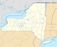
Ubicación en el condado de Greene en el estado de Nueva York
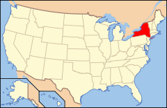
Map of USA NY.svg
Ubicación de Nueva York en EE. UU.
42°11′37″N 74°8′20″O / 42.19361, -74.13889Coordenadas: 42°11′37″N 74°8′20″O / 42.19361, -74.13889
Entidad Villa
 • País Bandera de los Estados Unidos Estados Unidos
 • Estado Flag of New York.svg Nueva York
 • Condado Greene
Superficie  
 • Total 3 km²
 • Tierra 2,9 km²
 • Agua (2,61%) 0,1 km²
Altitud  
 • Media 579 msnm
Población (2000)  
 • Total 448 hab.
 • Densidad 155 hab/km²
Huso horario Este: UTC-5
 • en verano UTC-4
Código ZIP 12424, 12485
Código de área 518
Sitio web oficial

Tannersville es una villa ubicada en el condado de Greene en el estado estadounidense de Nueva York. En el año 2000 tenía una población de 448 habitantes y una densidad poblacional de 155 personas por km².

Contenido

Geografía

Tannersville se encuentra ubicada en las coordenadas 42°11′37″N 74°8′20″O / 42.19361, -74.13889.[1]

Demografía

Según la Oficina del Censo en 2000 los ingresos medios por hogar en la localidad eran de $28,500, y los ingresos medios por familia eran $37,500. Los hombres tenían unos ingresos medios de $27,708 frente a los $27,000 para las mujeres. La renta per cápita para la localidad era de $15,318. Alrededor del 18.5% de la población estaban por debajo del umbral de pobreza.[2]

Referencias

  1. «U.S. Gazetteer: Censo de 2010» (en inglés). Oficina del Censo de los Estados Unidos (16 de febrero de 2011). Consultado el 11 de julio de 2011.
  2. «American FactFinder» (en inglés). Oficina del Censo de los Estados Unidos. Consultado el 11 de julio de 2011.

Enlaces externos


Wikimedia foundation. 2010.

Игры ⚽ Поможем решить контрольную работу

Mira otros diccionarios:

  • Tannersville — may refer to:* Tannersville, New York * Tannersville, Pennsylvania …   Wikipedia

  • Tannersville — Tannersville, NY U.S. village in New York Population (2000): 448 Housing Units (2000): 505 Land area (2000): 1.113292 sq. miles (2.883414 sq. km) Water area (2000): 0.031931 sq. miles (0.082700 sq. km) Total area (2000): 1.145223 sq. miles… …   StarDict's U.S. Gazetteer Places

  • Tannersville, NY — U.S. village in New York Population (2000): 448 Housing Units (2000): 505 Land area (2000): 1.113292 sq. miles (2.883414 sq. km) Water area (2000): 0.031931 sq. miles (0.082700 sq. km) Total area (2000): 1.145223 sq. miles (2.966114 sq. km) FIPS… …   StarDict's U.S. Gazetteer Places

  • Tannersville — Original name in latin Tannersville Name in other language State code US Continent/City America/New York longitude 41.04009 latitude 75.30574 altitude 274 Population 2784 Date 2011 06 29 …   Cities with a population over 1000 database

  • Tannersville, Virginia — Tannersville is an unincorporated community in Tazewell County, Virginia, United States …   Wikipedia

  • Tannersville, New York — Infobox Settlement official name = Tannersville, New York settlement type = Village nickname = motto = imagesize = image caption = image |pushpin pushpin label position = pushpin map caption =Location within the state of New York pushpin mapsize …   Wikipedia

  • Tannersville Railroad Station (New York) — There were two stations that served the town of Tannersville, New York.Ulster and DelawareThe original station at Tannersvile, New York, branch MP 14.6, was a lot like the Lanesville Station; a small building with a platform on each end. This… …   Wikipedia

  • Tannersville, Pennsylvania — The village of Tannersville, in Pocono Township, Pennsylvania, is the site of the popular Camelback Water Beach Ski Area. It is in the Eastern Standard time zone. Elevation is 883 feet. As of 2000, the population of Tannersville (ZIP Code 18372)… …   Wikipedia

  • Tannersville Railroad Station — A list of railroad stations that served a town called Tannnersville :* Tannersville Railroad Station (New York) * Tannersville Railroad Station (Pennsylvania) …   Wikipedia

  • Tannersville Cranberry Bog — lies beneath a six inch (152 mm) layer of sphagnum and a network of supporting tree roots. However, this bog may be viewed conveniently from a floating walkway.HistoryThe bog began as a kettle lake formed approximately 10,000 years ago by a… …   Wikipedia

Compartir el artículo y extractos

Link directo
Do a right-click on the link above
and select “Copy Link”