Thoubal

Thoubal
Thoubal
Localidad de la India
Thoubal
Thoubal
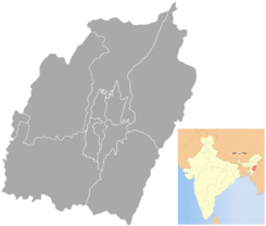
Ubicación de Thoubal en Manipur.
24°38′57″N 93°59′50″E / 24.64917, 93.99722Coordenadas: 24°38′57″N 93°59′50″E / 24.64917, 93.99722
Entidad Localidad
 • País Bandera de India India
 • Estado Manipur
 • Distrito Thoubal
Altitud  
 • Media 783 msnm
Población (Est.2010[1] )  
 • Total 48.721 hab.
Huso horario IST UTC +5:30
PIN[2] 795138
Código de área 3848

Thoubal es una localidad de la India, centro administrativo del distrito de Thoubal,en el estado de Manipur.

Contenido

Geografía

Se encuentra a una altitud de 783 msnm a 26 km de la capital estatal, Imfal, en la zona horaria UTC +5:30.

Demografía

Según estimación 2010 contaba con una población de 48 721 habitantes.[1]

Referencias

Enlaces externos


Wikimedia foundation. 2010.

Игры ⚽ Нужно сделать НИР?

Mira otros diccionarios:

  • Thoubal — Infobox Indian Jurisdiction native name = Thoubal | type = city | latd = 24.63 | longd = 94.02 locator position = left | state name = Manipur district = Thoubal leader title = leader name = altitude = 765 population as of = 2001 population total …   Wikipedia

  • Thoubal — Original name in latin Thoubl Name in other language Thoubal, Thoubl State code IN Continent/City Asia/Kolkata longitude 24.6388 latitude 93.99638 altitude 780 Population 44493 Date 2012 10 06 …   Cities with a population over 1000 database

  • Thoubal district — is one of the nine districts of Manipur state in northeastern India. This district is bounded by Senapati district on the north, Ukhrul and Chandel districts on the east, Churchandpur and Bishnupur districts on the south and Imphal West and… …   Wikipedia

  • Lilong (Thoubal) — Infobox Indian Jurisdiction native name = Lilong (Thoubal) | type = city | latd = | longd = state name = Manipur district = Thoubal leader title = leader name = altitude = population as of = 2001 population total = 20,267| population density =… …   Wikipedia

  • Maphou — (Lenghou Kho)   village   Coordinates Country India State Manipu …   Wikipedia

  • Manipur — মণিপুর   State   Seal …   Wikipedia

  • Sugnu — Infobox Indian Jurisdiction native name = Sugnu | type = city | latd = | longd = state name = Manipur district = Thoubal leader title = leader name = altitude = population as of = 2001 population total = 4507| population density = area magnitude …   Wikipedia

  • Okram Ibobi Singh — 11th Chief Minister of Manipur Incumbent Assumed office 7 March 2002 Preceded by Radhabinod Koijam Personal details Born …   Wikipedia

  • Kakching Khunou — Infobox Indian Jurisdiction native name = Kakching Khunou | type = city | latd = 24.54 | longd = 93.98 locator position = left | state name = Manipur district = Thoubal leader title = M. L. A. leader name = Kangujam Ranjit altitude = population… …   Wikipedia

  • List of India-related articles — Articles (arranged alphabetically) related to India or Indian culture include: NOTOC List of India related topics People are listed by their first names. 1231 SGM 3 STR 2002 Gujarat violence 2005 in India ( previous years ) 2004 Indian Ocean… …   Wikipedia

Compartir el artículo y extractos

Link directo
Do a right-click on the link above
and select “Copy Link”